MAPS OF HISTORY · The Decolonization of Africa · ALL CHAPTERS · CHAPTER 1
CHAPTER 1 · THE COLONIAL MAP OF 1945 · JAN 1945
How Thin the Empire Really Was
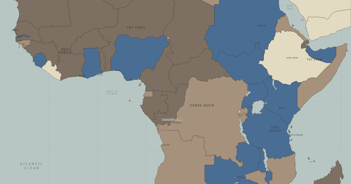
The map above is the world of 1945 — The colonial map.
BRIEF EXPLANATION — THE ESSENTIAL ARGUMENT
The question this atlas answers is how, within a single lifetime, a continent ruled almost entirely from Europe came to govern itself, and the answer begins with how shallow that rule actually was. In 1945 the map showed nearly all of Africa coloured for one empire or another, yet the colour overstated the control beneath it. Colonial states were tiny: Britain governed Nigeria’s roughly thirty million people through about 1,200 officials, and it could do so only by ruling through African chiefs, clerks, soldiers and labourers. That arrangement kept empire cheap, and it held for as long as those intermediaries went on cooperating.
The Second World War broke the conditions that had secured their cooperation. Around a million Africans served in the imperial armies and came home having seen European powers defeated and European soldiers die, which dissolved the aura of invincibility that had done much of colonialism’s work. The imperial economies were exhausted, and the Allies’ own wartime language, above all the Atlantic Charter’s promise that peoples should choose their government, handed nationalists a claim they could press against their rulers. Pan-African organizers then tied these grievances to mass politics. Empire had not vanished, but its finances, its prestige and its moral authority were all weaker than the map admitted.
GUIDED EXPLANATION
A colonial map is a claim about authority, and the depth of that authority is what actually decided how fast empire could be undone. Britain administered Nigeria’s millions with roughly 1,200 officials by delegating the daily work of rule to local chiefs and emirs, a doctrine known as indirect rule. The railways and roads it built ran from mine and plantation to the coast rather than linking African towns to one another, because the economy was arranged to move raw materials outward — Gold Coast cocoa, Rhodesian and Katangan copper, Congolese rubber and uranium, South African gold — and to send European manufactures back in. Almost nothing was invested in African industry or higher education, which is why the profit accumulated in Europe while the colony stayed a supplier.
The war then weakened the mechanism that had kept this structure stable. African troops fought across Asia and Europe and returned with wider expectations, while the imperial powers emerged defeated, occupied or bankrupt. The Atlantic Charter had committed the Allies in principle to the right of peoples to choose their government, and African editors held them to their own words. France’s 1944 Brazzaville conference promised reform yet explicitly forbade any move toward autonomy, and the 1945 Pan-African Congress in Manchester, attended by future rulers such as Nkrumah and Kenyatta, demanded independence outright. The empire remained in place, but the authority, the money and the arguments that sustained it were all giving way.
Colonial administration was astonishingly thin. “indirect rule,” Frederick Lugard’s doctrine, governed through existing chiefs and emirs precisely because Britain could not afford anything else. The same thinness that made empire cheap made it brittle: it depended on African collaboration, and the moment that collaboration became refusal, there was almost nothing behind it.
The men who would raise the flags were already formed by 1945. In the King’s African Rifles, the Sorbonne, Lincoln University, the London bedsits of Pan-Africanism. Decolonization was not a vacuum filled by chance. It was carried by a specific, named cohort with a worked-out idea of the nation-state.
DEEP EXPLANATION — EVIDENCE & INTERPRETATION
How a Handful of Officials Ruled Millions
Colonial power combined force with delegated authority, and the delegation is what made such small administrations possible. Britain’s system of indirect rule collected taxes and enforced policy through existing chiefs and emirs, while the French and Belgian empires claimed tighter central control but leaned just as heavily on African soldiers and clerks. This kept the cost of empire low and gave it reach into every village, yet it created a hidden dependency, because European authority now required continuous African participation. That participation was rarely willing consent. Chiefs, clerks and soldiers acted under coercion, pursued their own local advantage, or turned colonial institutions to their own ends, and the danger to empire came when nationalist movements linked these scattered actors into a single, coordinated refusal. The pattern is worth naming as brittle stability: a system can endure for decades simply because few people expect it to end, and then unravel quickly once that expectation changes. The thinness of colonial rule therefore explains both its long survival before 1945 and the startling speed with which it collapsed afterward.
What Colonial Economies Left Behind
Colonial economies were not uniformly primitive, but the investment that did occur followed imperial priorities rather than African ones. Transport was built to carry exports from a mine or plantation to a port, not to knit domestic markets together; education and African promotion were deliberately limited, most severely in the Belgian Congo; and tax systems were designed to push households into wage labour and cash crops. This produced revenue and raw materials for Europe while leaving the future states dependent on a narrow range of commodities whose prices were set in London and New York. The consequence for independence was structural rather than a matter of goodwill. New governments did not inherit nothing; they inherited institutions built for extraction, coercion and territorial control rather than for public services or democratic bargaining. Those institutions could in principle be repurposed, but doing so demanded trained staff, steady revenue and time that most states did not have. Independence changed who held power long before it could change what the state and the economy had been built to do.
New here? Chapters 1–2 of every atlas are free to sample, and the WW2 atlas is free in full. One membership opens all thirteen — the Cartographer’s Circle.
THE SITES
WHY IT HAPPENED
Rule by a handful, through intermediaries. Colonial administration was astonishingly thin. “indirect rule,” Frederick Lugard’s doctrine, governed through existing chiefs and emirs precisely because Britain could not afford anything else. The same thinness that made empire cheap made it brittle: it depended on African collaboration, and the moment that collaboration became refusal, there was almost nothing behind it.
An economy built for extraction, not development. Colonies were designed as suppliers of raw materials and buyers of finished goods. Roads and railways ran from mine and plantation to port, not town to town. Almost nothing was invested in African education or industry. At independence, the Belgian Congo had a handful of African university graduates for thirteen million people. The grievance this bred was economic as much as political.
The war as solvent. 1939–45 shattered the myth of European invincibility (Singapore, the fall of France) and mobilized Africa as never before. Soldiers, cash crops, forced labour. Veterans came home having killed white men and seen Europe’s weakness. The Atlantic Charter had put self-determination in the Allies’ own mouths. The colonizers had armed the argument against themselves.
Pan-Africanism finds its leaders. The 1945 Manchester Congress turned an intellectual movement. Du Bois, Padmore, Garvey’s inheritance. Into a political programme, and its delegates into the men who would rule: Nkrumah, Kenyatta, Hastings Banda. The ideas of liberation were in place, held by a generation about to go home and govern.
THE TURN
Brazzaville, January 1944. De Gaulle’s Free French, dependent on African troops and territory, convene to plan the post-war empire. They promise citizenship, representation, an end to forced labour. And declare that “any idea of autonomy, any possibility of evolution outside the French bloc, is to be discarded.” The contradiction. Reform to prevent change. Is the exact fault line that fifteen years will split wide open.
WHAT IT CHANGED
A generation of leaders in waiting. The men who would raise the flags were already formed by 1945. In the King’s African Rifles, the Sorbonne, Lincoln University, the London bedsits of Pan-Africanism. Decolonization was not a vacuum filled by chance. It was carried by a specific, named cohort with a worked-out idea of the nation-state.
Two roads out of empire. Where colonies had few white settlers, the exit could be negotiated (Ghana, Nigeria). Where a settler population had put down roots and property. Algeria, Kenya, Rhodesia, South Africa. The same demand met a wall, because now there was something concrete to defend. That distinction governs everything on this map.
The colonizers underestimate the clock. In 1945 London and Paris imagined reform stretching over generations. Within fifteen years the map would be unrecognizable. Almost no one. Colonized or colonizer. Foresaw the speed. That misjudgment shaped how unready both sides were for what came.
FIELD QUESTION — If the colonial system was so thin and cheap, why had it not fallen sooner — and why did it fall so fast after 1945?
Before 1945 the system held because it faced no coordinated challenge and Europe’s prestige seemed unbreakable: the thinness worked as long as Africans mostly cooperated and no rival demonstrated Europe could be beaten. The war removed both props at once. It beggared the imperial powers, mobilized and radicalized African populations, discredited white supremacy on the battlefield, and gave nationalists a global language of self-determination and a superpower (America, and the USSR) with reasons to encourage them. The lesson is that brittle systems can persist for decades and then collapse in a rush: what changed was not the machinery of rule but the willingness to obey it.
AN INTERESTING FACT
The Manchester congress was chaired by W. E. B. Du Bois — seventy-seven years old, organizer of the first Pan-African Congress back in 1919 — handing the movement in person to the generation that would govern; most of its delegates, unlike the exiled intellectuals of earlier congresses, were trade unionists, workers and students, meeting in a plain English town hall. And the Atlantic Charter cut deeper than its authors meant: Churchill assured the Commons in 1941 that self-determination applied only to Nazi-occupied Europe, but African editors — Nnamdi Azikiwe’s West African Pilot in Lagos among them — printed the words anyway and held the Allies to their own sentence.
THE DISPATCH
One short letter when a new atlas opens — and the printable study guide for The Decolonization of Africa is yours now, free.
NO TRACKING · YOUR ADDRESS IS USED FOR THE DISPATCH AND NOTHING ELSE · UNSUBSCRIBE ANYTIME