ONE LAND · 14 ATLASES
History of Albania in maps
Albania as it appears in 14 interactive history atlases, from 264 BC to 2015: Epirus & Illyria, Epirus & Dyrrhachium, Epirus, Albania. Each era below lists who ruled the land and when control changed, linked to the dated map that shows it.
WW2 is free — every chapter. No sign-up.
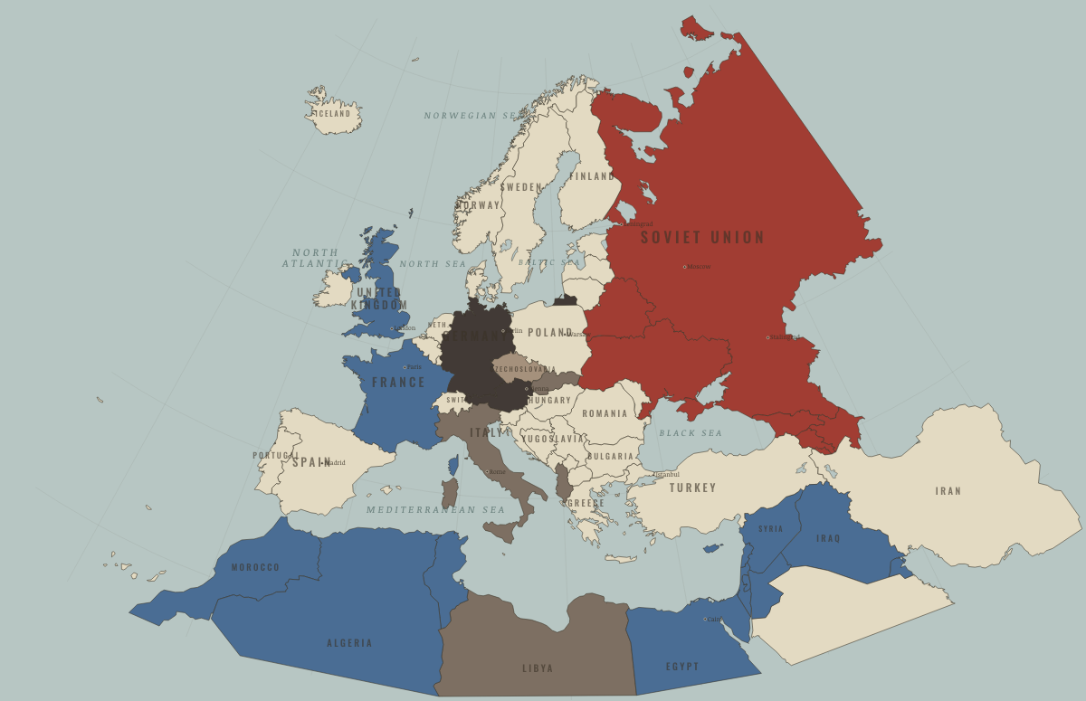
What was Albania before it was Albania? Below, every era of this land in the Maps of History atlases — who ruled it, what it was called, and when control changed — each line linked to the dated map that shows it. Modern borders stand in as an honest approximation; every atlas says so on the map itself.
Epirus & Illyria (mod. Albania) · Ancient Rome
Epirus and Illyria: Pyrrhus’ kingdom, whose Italian adventure (280–275 BC) taught Rome its own strength; later the coast whose pirate kingdoms drew Rome across the Adriatic — the first eastward step (229 BC). In 167 BC Aemilius Paullus enslaved 150,000 Epirotes in a single organized day: Roman conquest with the mask fully off.
| 264 BC | Hellenistic kingdoms — the opening position |
| 146 BC | Roman territory |
ANCIENT ROME: EVERY CHAPTER AND MAP →
Albania · Norse and Aztecs
| Other peoples and states — the opening position |
NORSE AND AZTECS: EVERY CHAPTER AND MAP →
Epirus & Dyrrhachium (mod. Albania) · Crusades
| Byzantium (and Latin Constantinople 1204–61) — the opening position |
CRUSADES: EVERY CHAPTER AND MAP →
Epirus (mod. Albania) · Mongol Empire
| Other settled powers (Jin China, Christendom, Delhi) — the opening position |
MONGOL EMPIRE: EVERY CHAPTER AND MAP →
Albania · Industrial Revolution
INDUSTRIAL REVOLUTION: EVERY CHAPTER AND MAP →
Albania · Age of Revolutions
| Neutral / uncommitted — the opening position |
AGE OF REVOLUTIONS: EVERY CHAPTER AND MAP →
Albania · Meiji Japan and post-Soviet Russia
| Non-aligned or stateless — the opening position |
MEIJI JAPAN AND POST-SOVIET RUSSIA: EVERY CHAPTER AND MAP →
Albania · WWI
Independent for barely two years when the war arrived — its borders drawn at London in 1913, its imported German prince gone within six months — Albania became everyone’s corridor: the Serbian army’s retreat crossed it (Ch. 6), and Austrian, Italian, French and Greek forces partitioned it in all but name; the secret Treaty of London had already promised slices of it to three of its “protectors.” It survived to 1920 as a state mostly because its occupiers exhausted each other — and because the Congress of Lushnjë refused every partition scheme and made Italy fight for Vlorë, which it declined to do for long.
Albania · Stalin’s Soviet Union
| Nazi Germany & its allies — the opening position | |
| Nazi Germany & its allies | |
| Satellites & communist allies |
STALIN’S SOVIET UNION: EVERY CHAPTER AND MAP →
Albania · Road to WW2
| Neutral & unaligned — the opening position | |
| The aggressors (Japan, Germany, Italy) |
ROAD TO WW2: EVERY CHAPTER AND MAP →
Albania · WW2
| Axis allies & puppets — the opening position | |
| Axis allies & puppets | |
| Soviet Union |
Albania · Cold War
| Soviet-aligned states — the opening position | |
| Communist, outside Moscow’s bloc | |
| Non-aligned & neutral | |
| Communist, outside Moscow’s bloc | |
| Non-aligned & neutral |
COLD WAR: EVERY CHAPTER AND MAP →
Albania · Feminism and the Tunisian Revolution
| Right won in law — the opening position | |
| No reform yet / outside this story |
FEMINISM AND THE TUNISIAN REVOLUTION: EVERY CHAPTER AND MAP →
Albania · Refugee crises
| Soviet-occupied or communist — the opening position |
REFUGEE CRISES: EVERY CHAPTER AND MAP →
Related
THE FREE PRINTABLE STUDY GUIDE
Join the Dispatch — a short welcome series, then a letter when a new atlas opens — and a printable atlas study guide of your choice is yours now, free.
NO TRACKING · YOUR ADDRESS IS USED FOR THE DISPATCH AND NOTHING ELSE · UNSUBSCRIBE ANYTIME