ONE LAND · 14 ATLASES
History of Egypt in maps
Egypt as it appears in 14 interactive history atlases, from 264 BC to 2015: Egypt, Egypt — Fatimid, then Ayyubid & Mamluk, Mamluk Egypt. Each era below lists who ruled the land and when control changed, linked to the dated map that shows it.
WW2 is free — every chapter. Try chapters 1–2 of any 2 other atlases (3 with a free account). Opening a new atlas uses one of them. Membership opens all 21 — Join.
Free printable Feminism and the Tunisian Revolution study guide, sent by email ↓
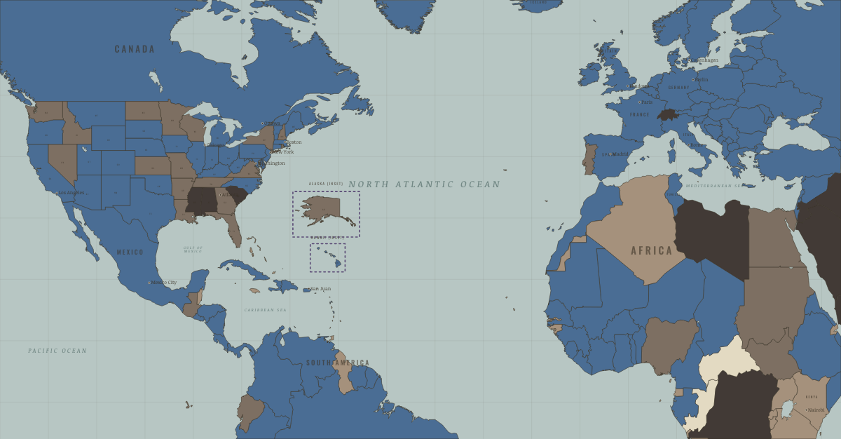
What was Egypt before it was Egypt? Below, every era of this land in the Maps of History atlases — who ruled it, what it was called, and when control changed — each line linked to the dated map that shows it. Modern borders stand in as an honest approximation; every atlas says so on the map itself.
Egypt · Ancient Rome
The last and richest Hellenistic kingdom, ruled by the Ptolemies from Alexandria — the ancient world’s scientific capital. Cleopatra VII played Caesar and Antony to keep it independent; Actium ended the game in 30 BC. As the emperor’s private estate, Egypt’s grain fed Rome and its taxes anchored the East — one reason the East survived (Ch. 11).
| 264 BC | Hellenistic kingdoms — the opening position |
| 30 BC | Roman territory |
| Breakaway Roman empires (260–274) | |
| Roman territory |
ANCIENT ROME: EVERY CHAPTER AND MAP →
Egypt — Fatimid, then Ayyubid & Mamluk · Crusades
Egypt was the strategic key to the whole war. The Shia Fatimid caliphate ruled it until Saladin abolished the dynasty in 1171 (watch the grey turn charcoal) and returned it to Sunni Islam; his Ayyubid heirs and then, from 1250, the Mamluk slave-soldiers made it the greatest power in the region. Every later crusade understood that Jerusalem could only be secured by taking Egypt — and most were destroyed on the Nile trying.
| Fatimid Egypt (Shia) — the opening position | |
| The Islamic powers — Seljuk, Zengid, Ayyubid, Mamluk |
CRUSADES: EVERY CHAPTER AND MAP →
Mamluk Egypt · Mongol Empire
The power that stopped the storm. The Mamluks — Qipchaq boys sold off the steppe, raised in Cairo’s barracks as slave-soldiers, sultans by coup — beat the Mongols with their own methods at Ain Jalut (1260) and again at Homs (1281), sheltered a shadow caliphate, and ruled as Islam’s sword for 250 years. The steppe, exported, defeated the steppe.
| The Islamic powers — the opening position |
MONGOL EMPIRE: EVERY CHAPTER AND MAP →
Egypt · Industrial Revolution
Muhammad Ali, ruler of Egypt from 1805 to 1848, tried to industrialise from above, building some thirty state cotton mills worked by conscripted labour in the 1830s. Without coal, and under treaties that forced open its market after 1838–41, the effort collapsed. Egypt became a cotton exporter instead, boomed during the American Civil War, borrowed heavily and fell under British occupation in 1882.
| Industrialising — the opening position | |
| Industrialising | |
| Opened by force or treaty | |
| Colony or dependency |
INDUSTRIAL REVOLUTION: EVERY CHAPTER AND MAP →
Egypt · Age of Revolutions
| Neutral / uncommitted — the opening position |
AGE OF REVOLUTIONS: EVERY CHAPTER AND MAP →
Egypt · Meiji Japan and post-Soviet Russia
MEIJI JAPAN AND POST-SOVIET RUSSIA: EVERY CHAPTER AND MAP →
Egypt (British occupation) · WWI
Nominally Ottoman, actually British since 1882, formally a British protectorate from December 1914: Egypt was the Entente’s Middle Eastern base — the Suez Canal defended, the Palestine campaign launched from it, and 1.5 million fellahin conscripted into labor corps. The bill came due in the 1919 revolution; nominal independence followed in 1922.
| Entente-aligned & imperial territories — the opening position | |
| Entente-aligned & imperial territories |
Egypt · Stalin’s Soviet Union
STALIN’S SOVIET UNION: EVERY CHAPTER AND MAP →
Egypt · Road to WW2
| Colonial empires & possessions — the opening position |
ROAD TO WW2: EVERY CHAPTER AND MAP →
Egypt · WW2
Nominally independent, actually Britain’s Middle East bastion: Alexandria based the Mediterranean Fleet, and El Alamein (Ch. 9) was fought 100 km from Cairo to keep Suez and Persian oil out of Axis hands.
| Western Allies — the opening position |
Egypt · Cold War
The Third World’s bellwether: British client, then Nasser’s non-aligned champion (Suez, Ch. 5), then Moscow’s biggest investment, then — after October 1973 bought back its honor and Sinai — Washington’s second-largest aid recipient (Ch. 8). Follow Egypt’s color changes across this map to watch the auction of alignment run in real time.
| US-aligned states — the opening position | |
| Non-aligned & neutral | |
| Soviet-aligned states | |
| US-aligned states | |
| Non-aligned & neutral | |
| Soviet-aligned states | |
| US-aligned states |
COLD WAR: EVERY CHAPTER AND MAP →
Egypt · Decolonization of Africa
Nominally independent since 1922 but under British sway until Nasser’s Free Officers deposed the king in 1952. Nasser’s nationalization of the Suez Canal in 1956, and his survival of the Anglo-French-Israeli invasion, made him the hero of Arab and African nationalism and Cairo a megaphone and training ground for liberation movements from Algeria to the Congo. The pivot of the continent’s north.
| Independent before 1945 — the opening position |
DECOLONIZATION OF AFRICA: EVERY CHAPTER AND MAP →
Egypt · Feminism and the Tunisian Revolution
Egypt’s revolution began on 25 January 2011, eleven days after Ben Ali fled, and Hosni Mubarak resigned on 11 February. Egyptians elected the Muslim Brotherhood’s Mohamed Morsi president in 2012, but on 3 July 2013 the army removed him and in August killed hundreds of his supporters in Cairo. Tunisia’s politicians watched and chose compromise.
FEMINISM AND THE TUNISIAN REVOLUTION: EVERY CHAPTER AND MAP →
Egypt · Refugee crises
REFUGEE CRISES: EVERY CHAPTER AND MAP →
Related
THE FREE PRINTABLE STUDY GUIDE
Join the Dispatch — a short welcome series, then a letter when a new atlas opens — and a printable atlas study guide of your choice is yours now, free.
NO TRACKING · YOUR ADDRESS IS USED FOR THE DISPATCH AND NOTHING ELSE · UNSUBSCRIBE ANYTIME