ONE LAND · 12 ATLASES
History of India in maps
India as it appears in 12 interactive history atlases, from 1206 to 2000: Delhi Sultanate, India, British India. Each era below lists who ruled the land and when control changed, linked to the dated map that shows it.
WW2 is free — every chapter. Try chapters 1–2 of any 2 other atlases (3 with a free account). Opening a new atlas uses one of them. Membership opens all 21 — Join.
Free printable Industrial Revolution study guide, sent by email ↓
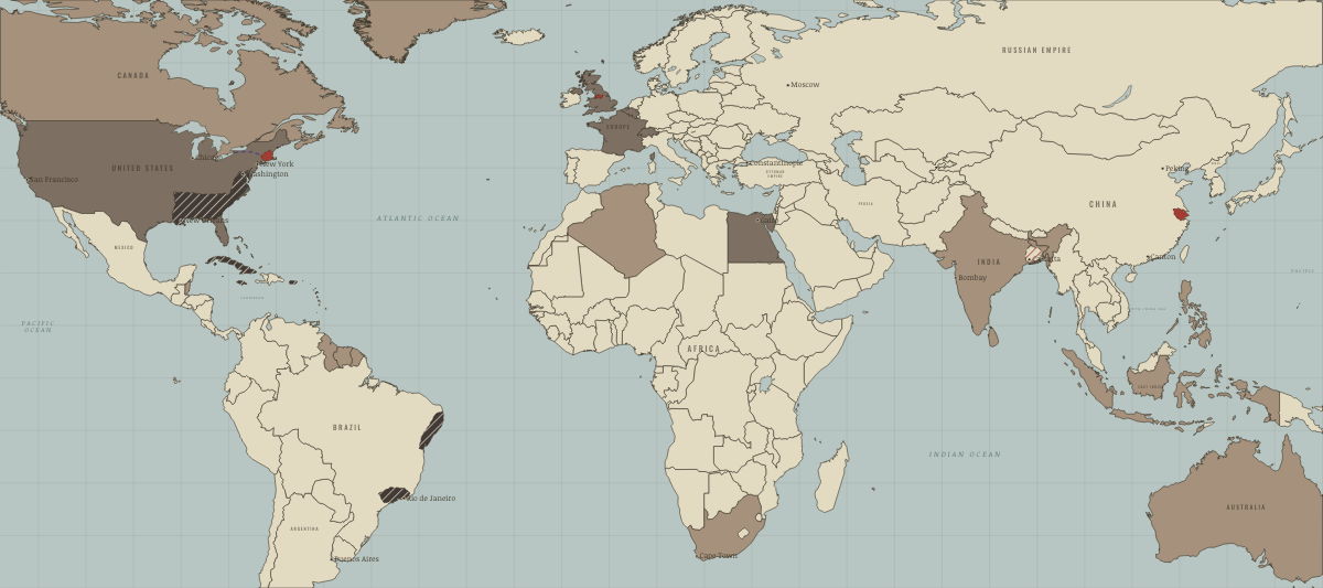
What was India before it was India? Below, every era of this land in the Maps of History atlases — who ruled it, what it was called, and when control changed — each line linked to the dated map that shows it. Modern borders stand in as an honest approximation; every atlas says so on the map itself.
Delhi Sultanate (mod. India) · Mongol Empire
The Delhi Sultanate parried Mongol raids at the passes for eighty years — fortress lines, a standing steppe-style cavalry army, and Alauddin Khalji’s price controls to feed it. The monsoon plains never turned red on this map: like the Mamluks, Delhi shows that the Mongols’ mirror — professional horse-archers with a state behind them — could hold the line.
| Other settled powers (Jin China, Christendom, Delhi) — the opening position |
MONGOL EMPIRE: EVERY CHAPTER AND MAP →
India · Industrial Revolution
In 1750 the subcontinent made perhaps a quarter of the world’s manufactured goods; by 1900, under two per cent. Under British rule its handloom weavers lost their export markets, its farmers grew cotton, jute, indigo, wheat and opium for world markets, and its railways were built with returns guaranteed from Indian taxes. Indian merchants answered by building cotton mills in Bombay and Ahmedabad, and nationalists made the drain of wealth a political cause.
| Colony or dependency — the opening position | |
| Colony or dependency |
INDUSTRIAL REVOLUTION: EVERY CHAPTER AND MAP →
India (British) · Meiji Japan and post-Soviet Russia
| Western powers and allies — the opening position |
MEIJI JAPAN AND POST-SOVIET RUSSIA: EVERY CHAPTER AND MAP →
India (the British Raj to 1947; the Republic from 1950) · Indian independence
The heart of the map and of the struggle: British India’s provinces in charcoal, the princely patchwork in tan, and — from 15 August 1947 — the Indian Union in red. Freedom came by the largest mass movement in history, at the price of partition’s amputations; the republic that followed (constitution 1950, drafted under Ambedkar) made a universal-franchise democracy of 340 million against every colonial prediction. Scrub the timeline: the color barely changes for ninety years after 1857, and then changes utterly in one August.
| British India — direct rule — the opening position | |
| Self-rule / independent |
INDIAN INDEPENDENCE: EVERY CHAPTER AND MAP →
British India · WWI
British India sent 1.4 million soldiers and laborers — the largest volunteer force yet raised — to Flanders, Gallipoli, East Africa and Mesopotamia, where Indian divisions took Baghdad (Ch. 10). India paid in famine-level inflation and the influenza’s worst toll on earth. The promised reward became the Amritsar massacre and sham reforms: the war made the Raj unpayable, and Gandhi its creditor.
| Entente-aligned & imperial territories — the opening position |
British India · Chinese Revolution
British India is the empire behind the map’s southwest rim: source of the Indian Army battalions that policed Shanghai’s Settlement, terminus of the Hump airlift from Assam’s fields, and base for the Burma campaigns that reopened China’s road. Its soldiers fight across this atlas while its politicians sit in British prisons demanding the independence that arrives, blood-soaked by Partition, in 1947 — two years before this map’s own succession is settled. The two new giants of Asia enter the 1950s as neighbors with an undemarcated Himalayan line; that, too, is this era’s unfinished business.
| Foreign empires — British, French, Russian, American — the opening position |
CHINESE REVOLUTION: EVERY CHAPTER AND MAP →
India (British India until 1947) · Stalin’s Soviet Union
STALIN’S SOVIET UNION: EVERY CHAPTER AND MAP →
British India · Road to WW2
The empire’s unconsulted arsenal: declared at war in September 1939 by the Viceroy’s signature, without a single Indian legislator’s vote — a fact that reshaped nationalist politics for good. Two and a half million Indians would nonetheless volunteer, the largest volunteer army in history, even as the independence movement asked the question the tan on this map begs: whose war, for whose freedom?
| Colonial empires & possessions — the opening position |
ROAD TO WW2: EVERY CHAPTER AND MAP →
India · WW2
Two and a half million volunteers — history’s largest all-volunteer force — fought from Ethiopia to Burma, while famine killed millions in Bengal (1943) and the independence movement surged. India’s WW2 is imperial contribution and imperial grievance simultaneously; independence came within two years of victory.
| Western Allies — the opening position |
India · Cold War
Non-alignment’s co-founder and proof of concept: Soviet steel mills, American wheat, lectures for both (Ch. 8). It fought wars with US-armed Pakistan and with China, signed a Soviet friendship treaty in 1971, and tested a bomb in 1974 — all while refusing every bloc. The largest democracy spent the era demonstrating that “Third World” named a strategy, not a rank.
| NATO & core Western allies — the opening position | |
| Non-aligned & neutral |
COLD WAR: EVERY CHAPTER AND MAP →
India · Refugee crises
REFUGEE CRISES: EVERY CHAPTER AND MAP →
India · Mao’s China
India recognised the People’s Republic in December 1949 and accepted Chinese rule in Tibet in 1954, under the slogan that Indians and Chinese were brothers. The Dalai Lama’s flight in 1959 and China’s road across Aksai Chin turned friendship into a border dispute, and in 1962 the PLA routed Indian forces before withdrawing. India sheltered about 80,000 Tibetan refugees and the Tibetan government-in-exile at Dharamsala.
| Neutral, non-aligned or colonial — the opening position | |
| Beijing’s adversaries |
MAO’S CHINA: EVERY CHAPTER AND MAP →
Related
THE FREE PRINTABLE STUDY GUIDE
Join the Dispatch — a short welcome series, then a letter when a new atlas opens — and a printable atlas study guide of your choice is yours now, free.
NO TRACKING · YOUR ADDRESS IS USED FOR THE DISPATCH AND NOTHING ELSE · UNSUBSCRIBE ANYTIME