ONE LAND · 6 ATLASES
History of Indonesia in maps
Indonesia as it appears in 6 interactive history atlases, from 1750 to 1991: the Dutch East Indies, Indonesia. Each era below lists who ruled the land and when control changed, linked to the dated map that shows it.
WW2 is free — every chapter. No sign-up.
What was Indonesia before it was Indonesia? Below, every era of this land in the Maps of History atlases — who ruled it, what it was called, and when control changed — each line linked to the dated map that shows it. Modern borders stand in as an honest approximation; every atlas says so on the map itself.
The Dutch East Indies (mod. Indonesia) · Industrial Revolution
| Colony or dependency — the opening position |
INDUSTRIAL REVOLUTION: EVERY CHAPTER AND MAP →
Dutch East Indies · WWI
The Dutch East Indies (mod. Indonesia) · Road to WW2
| Colonial empires & possessions — the opening position |
ROAD TO WW2: EVERY CHAPTER AND MAP →
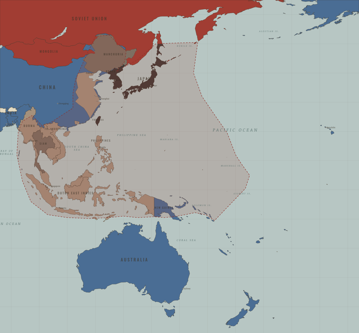
Indonesia · WW2
The Dutch East Indies — the oil prize the Pacific war was fought for (Ch. 7). Japanese occupation broke Dutch authority forever; nationalist leader Sukarno declared independence two days after Japan’s surrender, starting a four-year war the Netherlands lost.
| Western Allies — the opening position | |
| Axis-occupied | |
| Western Allies |
Indonesia · Cold War
Host of Bandung (1955), where the Third World named itself (Ch. 8). Sukarno’s balancing act ended in 1965–66 with an army takeover and the massacre of perhaps half a million alleged communists — one of the era’s worst atrocities, abetted with Western lists and approval, and long left off maps. Suharto’s Indonesia stayed Western-aligned for three decades.
| NATO & core Western allies — the opening position | |
| Non-aligned & neutral | |
| US-aligned states |
COLD WAR: EVERY CHAPTER AND MAP →
Indonesia · Refugee crises
Indonesia sheltered boat people who landed in the Anambas islands and in 1979 gave the island of Galang to a UNHCR processing centre, where tens of thousands waited and studied before resettlement. Like Malaysia and Thailand it never signed the Refugee Convention. The camp closed in 1996, and its grounds, with a cemetery and a chapel built by refugees, are now a memorial park.
| First asylum open — the opening position | |
| First asylum open | |
| First asylum restricted | |
| First asylum open |
REFUGEE CRISES: EVERY CHAPTER AND MAP →
Related
THE FREE PRINTABLE STUDY GUIDE
Join the Dispatch — a short welcome series, then a letter when a new atlas opens — and a printable atlas study guide of your choice is yours now, free.
NO TRACKING · YOUR ADDRESS IS USED FOR THE DISPATCH AND NOTHING ELSE · UNSUBSCRIBE ANYTIME