ONE LAND · 10 ATLASES
History of Kyrgyzstan in maps
Kyrgyzstan as it appears in 10 interactive history atlases, from 1206 to 2000: Semirechye — Kara-Khitai, Kyrgyzstan, Russian Turkestan, Soviet Central Asia, Kirghizia. Each era below lists who ruled the land and when control changed, linked to the dated map that shows it.
WW2 is free — every chapter. Try chapters 1–2 of any 2 other atlases (3 with a free account). Opening a new atlas uses one of them. Membership opens all 21 — Join.
Free printable Russian Revolution study guide, sent by email ↓
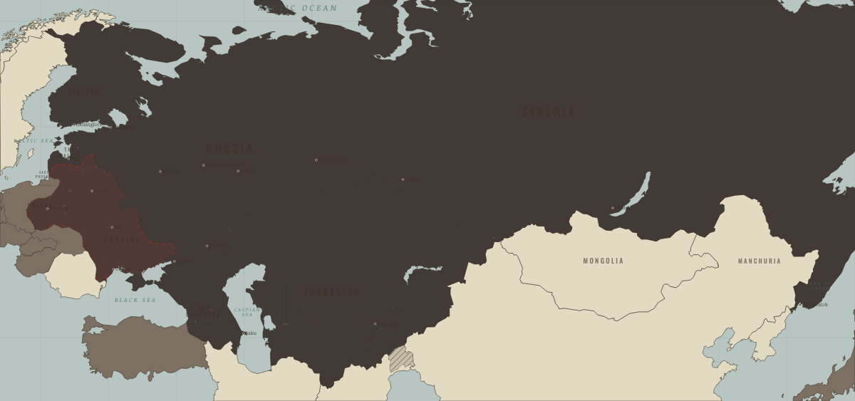
What was Kyrgyzstan before it was Kyrgyzstan? Below, every era of this land in the Maps of History atlases — who ruled it, what it was called, and when control changed — each line linked to the dated map that shows it. Modern borders stand in as an honest approximation; every atlas says so on the map itself.
Semirechye — Kara-Khitai (mod. Kyrgyzstan) · Mongol Empire
| Beyond the storm — the opening position | |
| The Mongol Empire |
MONGOL EMPIRE: EVERY CHAPTER AND MAP →
Kyrgyzstan · Industrial Revolution
| Colony or dependency — the opening position | |
| Colony or dependency |
INDUSTRIAL REVOLUTION: EVERY CHAPTER AND MAP →
Kyrgyzstan (Kirghizia) · Meiji Japan and post-Soviet Russia
Kyrgyzstan, a mountain republic, elected the physicist Askar Akayev as its leader in 1990, and in the 1990s it gained a reputation as the most open Central Asian state, carrying out rapid market reforms. Deadly clashes between Kyrgyz and Uzbeks around Osh in 1990 had already shown how fragile the Soviet borders drawn across the Ferghana valley were.
| The USSR, then Russia — the opening position | |
| Independent neighbours |
MEIJI JAPAN AND POST-SOVIET RUSSIA: EVERY CHAPTER AND MAP →
Russian Turkestan (mod. Kyrgyzstan) · Russian Revolution
The Chu valley and Issyk-Kul passed to Russia in the 1850s and 1860s, and the south followed when Russia abolished the khanate of Kokand in 1876. The Kyrgyz lands entered the revolution already bleeding: the 1916 conscription revolt (the Urkun, “the exodus”) was crushed with such violence that perhaps 100,000–270,000 Kyrgyz and Kazakhs died or perished fleeing over the passes to China — estimates vary enormously, and the memory is still contested. Mountainous and remote, the region was then part of the isolated Turkestan theatre, cut off from central Russia for much of the civil war, reconquered as the Reds broke through in 1919–20, and folded into the Soviet federation.
| Neutral or independent — the opening position | |
| The Tsarist empire | |
| Provisional Government, then the Whites | |
| Contested / peasant war | |
| Soviet power |
RUSSIAN REVOLUTION: EVERY CHAPTER AND MAP →
Kyrgyzstan · WWI
| The Entente & Allies — the opening position | |
| Russia in revolution |
Soviet Central Asia (mod. Kyrgyzstan) · Chinese Revolution
| Foreign empires — British, French, Russian, American — the opening position |
CHINESE REVOLUTION: EVERY CHAPTER AND MAP →
Kirghizia (Kirghiz SSR from 1936) · Stalin’s Soviet Union
Kirghizia was an autonomous region of Russia from 1924 and became a union republic in 1936. Its herders, like the Kazakhs, were forced onto collective farms and many fled with their animals across the mountains into China. In 1944 the republic received deported Chechens, Ingush and Balkars. Its capital, Pishpek, was renamed Frunze in 1926 after the civil-war commander born there.
| The Soviet Union — the opening position |
STALIN’S SOVIET UNION: EVERY CHAPTER AND MAP →
Kyrgyzstan · Road to WW2
| Neutral & unaligned — the opening position | |
| Aggressor clients & partners | |
| Democracies & powers fighting them |
ROAD TO WW2: EVERY CHAPTER AND MAP →
Kyrgyzstan · Cold War
| USSR & Warsaw Pact — the opening position | |
| Non-aligned & neutral |
COLD WAR: EVERY CHAPTER AND MAP →
Soviet Central Asia (mod. Kyrgyzstan) · Mao’s China
| Beijing’s allies and friends — the opening position | |
| Beijing’s adversaries |
MAO’S CHINA: EVERY CHAPTER AND MAP →
Related
THE FREE PRINTABLE STUDY GUIDE
Join the Dispatch — a short welcome series, then a letter when a new atlas opens — and a printable atlas study guide of your choice is yours now, free.
NO TRACKING · YOUR ADDRESS IS USED FOR THE DISPATCH AND NOTHING ELSE · UNSUBSCRIBE ANYTIME