ON THIS DAY ·
Anschluss
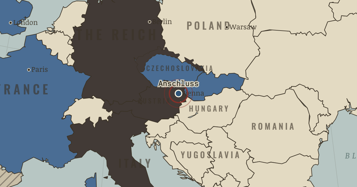
12–13 Mar 1938 — German troops cross into Austria to cheering crowds; Vienna’s Jews are scrubbing pavements within days. A country vanishes from the map without a shot.
WW2 is free — every chapter. Try chapters 1–2 of any 2 other atlases (3 with a free account). Opening a new atlas uses one of them. Membership opens all 21 — Join.
The moment in context
German troops entered Austria in March 1938, and the country was annexed to the Reich. Public celebration went hand in hand with immediate persecution, above all of Austria’s Jews. The annexation also reshaped the map, placing German territory on three sides of Czechoslovakia and leaving the democracy that France was pledged to defend nearly surrounded.
From Anschluss and the Munich Agreement, chapter 7 of The Road to War, 1931–1941 (1938).
The place: Anschluss — map and full story →
Teach this in 5 minutes
- Why it happened — The bomber, the trenches and 1914. Appeasement was not mere cowardice; it was a theory of the world held by serious men with terrible memories. The guiding nightmares: another 1914,…
- The turn — Munich, 29–30 September 1938. Munich is the word every later generation reaches for when it debates concession, which is precisely why it needs careful handling. The turn is…
- What it changed — Czechoslovakia is disarmed for its conquerors. The Wehrmacht that rolled into Prague in March 1939 (Ch. 8) — and into France in 1940 — did so partly on Czech steel: a third of the German army’s…
Then ask the room: Was Munich a betrayal, a blunder, or the best of the bad options available to Chamberlain in September 1938? The argued answer is on the chapter page →
The atlas that shows it
THE FREE PRINTABLE STUDY GUIDE
Join the Dispatch — a short welcome series, then a letter when a new atlas opens — and the printable study guide for The Road to War is yours now, free.
NO TRACKING · YOUR ADDRESS IS USED FOR THE DISPATCH AND NOTHING ELSE · UNSUBSCRIBE ANYTIME