ON THIS DAY ·
Fall of Acre
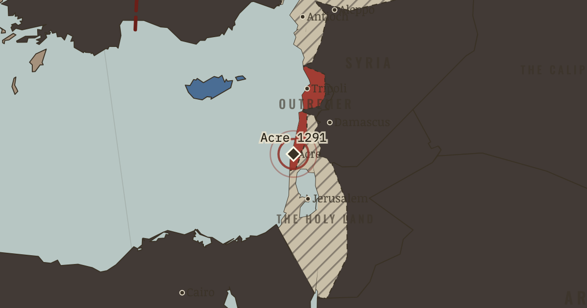
18 May 1291 — the last great city of Outremer falls tower by tower after six weeks of siege; the final defenders drown or die on the mole. Two centuries of crusader rule on the mainland end in a single morning. A site of memory.
WW2 is free — every chapter. Try chapters 1–2 of any 2 other atlases (3 with a free account). Opening a new atlas uses one of them. Membership opens all 21 — Join.
The moment in context
The instrument of Outremer’s end was, once again, a slave-soldier state, and its rise ran through two great shocks. At La Forbie near Gaza in 1244 an allied Frankish and Damascene army was destroyed by Egyptian forces and the Khwarezmian mercenaries who had just sacked Jerusalem, and this was the last time the crusader states fielded an army of any real size. Then the Mongols swept in, extinguishing Baghdad and the Abbasid caliphate, until at Ain Jalut in 1260 the Mamluks of Egypt halted them in Galilee. That victory did more than save the region, because it forged a disciplined, self-renewing military state, built on a slave-soldier system the Muslim world had used for centuries, that could now turn methodically against the crusader coast.
From Fall of the crusader states, chapter 11 of The Crusades, 1095–1291 (1271).
The place: Fall of Acre — map and full story →
Teach this in 5 minutes
- Why it happened — The Mamluk military state. The Mamluks were a professional army of slave-soldiers, trained from boyhood, promoted by merit, and renewed by purchase rather than birth — an…
- The turn — Ain Jalut, 3 September 1260. The battle that made the machine. By halting the Mongols in Galilee, the Mamluks both removed the crusaders’ last conceivable ally and won the…
- What it changed — Outremer erased. Watch the map: the last red drains to lost-hatch along the whole coast, and only Cyprus remains Latin. The mainland crusader states, born in 1099,…
Then ask the room: Why did Europe not send a fleet to save Acre in 1291? The argued answer is on the chapter page →
The atlas that shows it
THE FREE PRINTABLE STUDY GUIDE
Join the Dispatch — a short welcome series, then a letter when a new atlas opens — and the printable study guide for The Crusades is yours now, free.
NO TRACKING · YOUR ADDRESS IS USED FOR THE DISPATCH AND NOTHING ELSE · UNSUBSCRIBE ANYTIME