ONE LAND · 11 ATLASES
History of Algeria in maps
Algeria as it appears in 11 interactive history atlases, from 264 BC to 2015: Numidia, Algeria, French Algeria. Each era below lists who ruled the land and when control changed, linked to the dated map that shows it.
WW2 is free — every chapter. No sign-up.
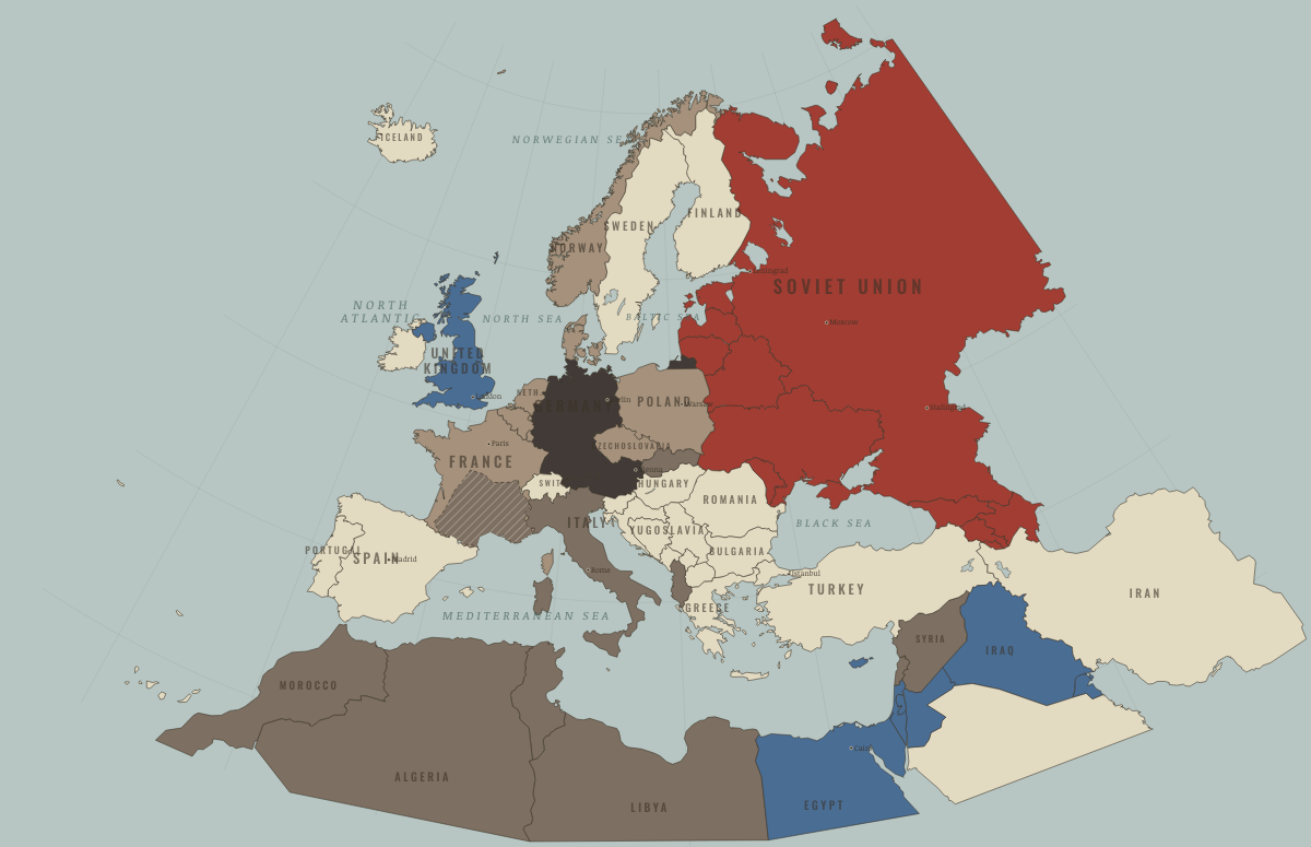
What was Algeria before it was Algeria? Below, every era of this land in the Maps of History atlases — who ruled it, what it was called, and when control changed — each line linked to the dated map that shows it. Modern borders stand in as an honest approximation; every atlas says so on the map itself.
Numidia (mod. Algeria) · Ancient Rome
Numidia: Masinissa’s cavalry kingdom chose Rome before Zama and tormented Carthage into the Third Punic War. Jugurtha’s war against Rome (112–106 BC) made Marius’ career — and thus, indirectly, the client-army Republic-killer (Ch. 4). Later a granary province and the homeland of Augustine of Hippo, who watched the Vandals besiege his city as he died in 430.
| 264 BC | Tribal peoples & confederations — the opening position |
| 201 BC | Roman clients & allies |
| 30 BC | Roman territory |
| Former Roman lands (lost) |
ANCIENT ROME: EVERY CHAPTER AND MAP →
Algeria · Industrial Revolution
| Colony or dependency — the opening position | |
| Colony or dependency |
INDUSTRIAL REVOLUTION: EVERY CHAPTER AND MAP →
Algeria · Age of Revolutions
| Neutral / uncommitted — the opening position |
AGE OF REVOLUTIONS: EVERY CHAPTER AND MAP →
Algeria · Meiji Japan and post-Soviet Russia
MEIJI JAPAN AND POST-SOVIET RUSSIA: EVERY CHAPTER AND MAP →
Algeria (French) · WWI
| Entente-aligned & imperial territories — the opening position | |
| Entente-aligned & imperial territories |
French Algeria · Road to WW2
| Colonial empires & possessions — the opening position |
ROAD TO WW2: EVERY CHAPTER AND MAP →
Algeria · WW2
| Western Allies — the opening position | |
| Axis allies & puppets | |
| Western Allies |
Algeria · Cold War
| NATO & core Western allies — the opening position | |
| Non-aligned & neutral |
COLD WAR: EVERY CHAPTER AND MAP →
Algeria · Decolonization of Africa
Algeria was the exception that explains the map: not a colony but, in French law, part of France, home to a million European settlers. The FLN’s war of 1954–62 — Sétif’s prelude, the Battle of Algiers, torture, the OAS’s scorched exit — cost perhaps hundreds of thousands of lives and brought down France’s Fourth Republic before winning independence in July 1962. A settler war fought to the bitter end, and a template studied across southern Africa.
| French-ruled — the opening position | |
| Independent Africa |
DECOLONIZATION OF AFRICA: EVERY CHAPTER AND MAP →
Algeria (French until 1962) · Feminism and the Tunisian Revolution
Algeria was a French colony until 1962, won after a war of independence, and its 1984 Family Code kept polygamy and a husband’s guardianship, a contrast with Tunisia’s Personal Status Code. A civil war between the army and Islamist insurgents in the 1990s killed somewhere between 100,000 and 200,000 people, a memory that made many Algerians wary of revolution in 2011.
| Authoritarian, one-party or colonial rule — the opening position | |
| Right won in law | |
| No reform yet / outside this story | |
| No reform yet / outside this story | |
| Authoritarian, one-party or colonial rule |
FEMINISM AND THE TUNISIAN REVOLUTION: EVERY CHAPTER AND MAP →
Algeria · Refugee crises
| Western bloc or democracy — the opening position |
REFUGEE CRISES: EVERY CHAPTER AND MAP →
Related
THE FREE PRINTABLE STUDY GUIDE
Join the Dispatch — a short welcome series, then a letter when a new atlas opens — and a printable atlas study guide of your choice is yours now, free.
NO TRACKING · YOUR ADDRESS IS USED FOR THE DISPATCH AND NOTHING ELSE · UNSUBSCRIBE ANYTIME