The War Room — WW2, 1936–1945 · THE MAP IN
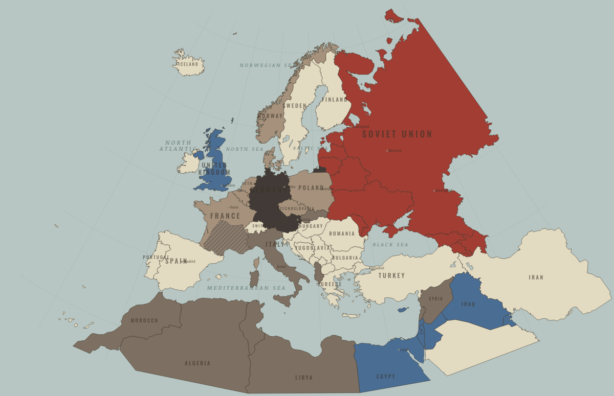
Map of Europe in June 1940
France falls · WW2
Europe in June 1940: France falls. Since October 1939, 15 territories changed status on this map: including Denmark, Norway, Netherlands and 12 more.
Open this map in the interactive atlas →
WW2 is free — every chapter. No sign-up.
What changes on the map
| Denmark | — → Axis-occupied |
| Norway | — → Axis-occupied |
| Netherlands | — → Axis-occupied |
| Belgium | — → Axis-occupied |
| Luxembourg | — → Axis-occupied |
| France | Western Allies → Axis-occupied |
| Estonia | — → Soviet Union |
| Latvia | — → Soviet Union |
| Lithuania | — → Soviet Union |
| Moldova | — → Soviet Union |
| Syria | Western Allies → Axis allies & puppets |
| Lebanon | Western Allies → Axis allies & puppets |
| Algeria | Western Allies → Axis allies & puppets |
| Tunisia | Western Allies → Axis allies & puppets |
| Morocco | Western Allies → Axis allies & puppets |
On the ground
- occupied north; Vichy-governed south
The chapters of this moment
Related maps
THE FREE PRINTABLE STUDY GUIDE
Join the Dispatch — a short welcome series, then a letter when a new atlas opens — and the printable study guide for WW2 is yours now, free.
NO TRACKING · YOUR ADDRESS IS USED FOR THE DISPATCH AND NOTHING ELSE · UNSUBSCRIBE ANYTIME