ONE LAND · 7 ATLASES
History of Canada in maps
Canada as it appears in 7 interactive history atlases, from 790 to 2015: Northern North America, Canada, British North America. Each era below lists who ruled the land and when control changed, linked to the dated map that shows it.
WW2 is free — every chapter. Try chapters 1–2 of any 2 other atlases (3 with a free account). Opening a new atlas uses one of them. Membership opens all 21 — Join.
Free printable Feminism and the Tunisian Revolution study guide, sent by email ↓
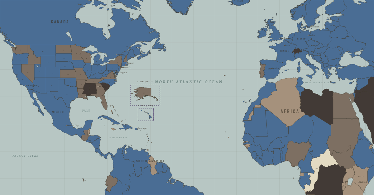
What was Canada before it was Canada? Below, every era of this land in the Maps of History atlases — who ruled it, what it was called, and when control changed — each line linked to the dated map that shows it. Modern borders stand in as an honest approximation; every atlas says so on the map itself.
Northern North America · Norse and Aztecs
| Indigenous peoples of the North — the opening position |
NORSE AND AZTECS: EVERY CHAPTER AND MAP →
Canada (British North America) · Industrial Revolution
A British dominion that shipped wheat, timber and fish to industrial Britain and built a transcontinental railway, the Canadian Pacific, completed in 1885, to hold a continent together. Factories grew in Ontario and Quebec behind tariffs from 1879, and by 1914 hundreds of thousands of migrants had settled its prairie farms.
| Colony or dependency — the opening position |
INDUSTRIAL REVOLUTION: EVERY CHAPTER AND MAP →
British North America (mod. Canada) · Age of Revolutions
The empire’s keep: Loyalist refuge after 1783, it repelled American invasion in 1812 and became the laboratory where Britain learned the age’s lesson without a war — after the 1837–38 rebellions, the Durham Report traded autonomy for loyalty. The road not taken in 1776, running parallel ever since.
| Britain & its empire — the opening position |
AGE OF REVOLUTIONS: EVERY CHAPTER AND MAP →
British North America (Canada) · American Civil War
British North America was the Underground Railroad’s terminus — some 30,000–40,000 Black refugees from slavery had settled here by 1861, beyond the Fugitive Slave Act’s reach. It was also a Confederate base: agents in Montreal and Toronto plotted raids, including the October 1864 St. Albans bank raid into Vermont, straining London–Washington relations already scarred by the Trent affair. Fear of the huge Union army’s postwar intentions was one spur to Confederation in 1867 — the Dominion of Canada is, in part, a consequence of this war.
| Neighbors & the outside world — the opening position |
AMERICAN CIVIL WAR: EVERY CHAPTER AND MAP →
Canada · WWI
Canada entered automatically with Britain and earned separateness in the fighting: Ypres under gas (Ch. 6), Vimy Ridge — taken by all four Canadian divisions together, Easter 1917, a national founding moment — and the Hundred Days with the BEF’s best shock troops (Ch. 12). 61,000 dead from eight million people; a separate signature at Versailles.
| Entente-aligned & imperial territories — the opening position |
Canada · Cold War
| NATO & core Western allies — the opening position |
COLD WAR: EVERY CHAPTER AND MAP →
Canada · Feminism and the Tunisian Revolution
| Partial or unequal; treaty signed only; transition — the opening position | |
| Right won in law | |
| Partial or unequal; treaty signed only; transition | |
| No reform yet / outside this story | |
| Right won in law |
FEMINISM AND THE TUNISIAN REVOLUTION: EVERY CHAPTER AND MAP →
Related
THE FREE PRINTABLE STUDY GUIDE
Join the Dispatch — a short welcome series, then a letter when a new atlas opens — and a printable atlas study guide of your choice is yours now, free.
NO TRACKING · YOUR ADDRESS IS USED FOR THE DISPATCH AND NOTHING ELSE · UNSUBSCRIBE ANYTIME