ONE LAND · 7 ATLASES
History of the Dominican Republic in maps
The Dominican Republic as it appears in 7 interactive history atlases, from 1750 to 2015: Dominican Republic, Santo Domingo. Each era below lists who ruled the land and when control changed, linked to the dated map that shows it.
WW2 is free — every chapter. Try chapters 1–2 of any 2 other atlases (3 with a free account). Opening a new atlas uses one of them. Membership opens all 21 — Join.
Free printable Haiti and Kenya independence study guide, sent by email ↓
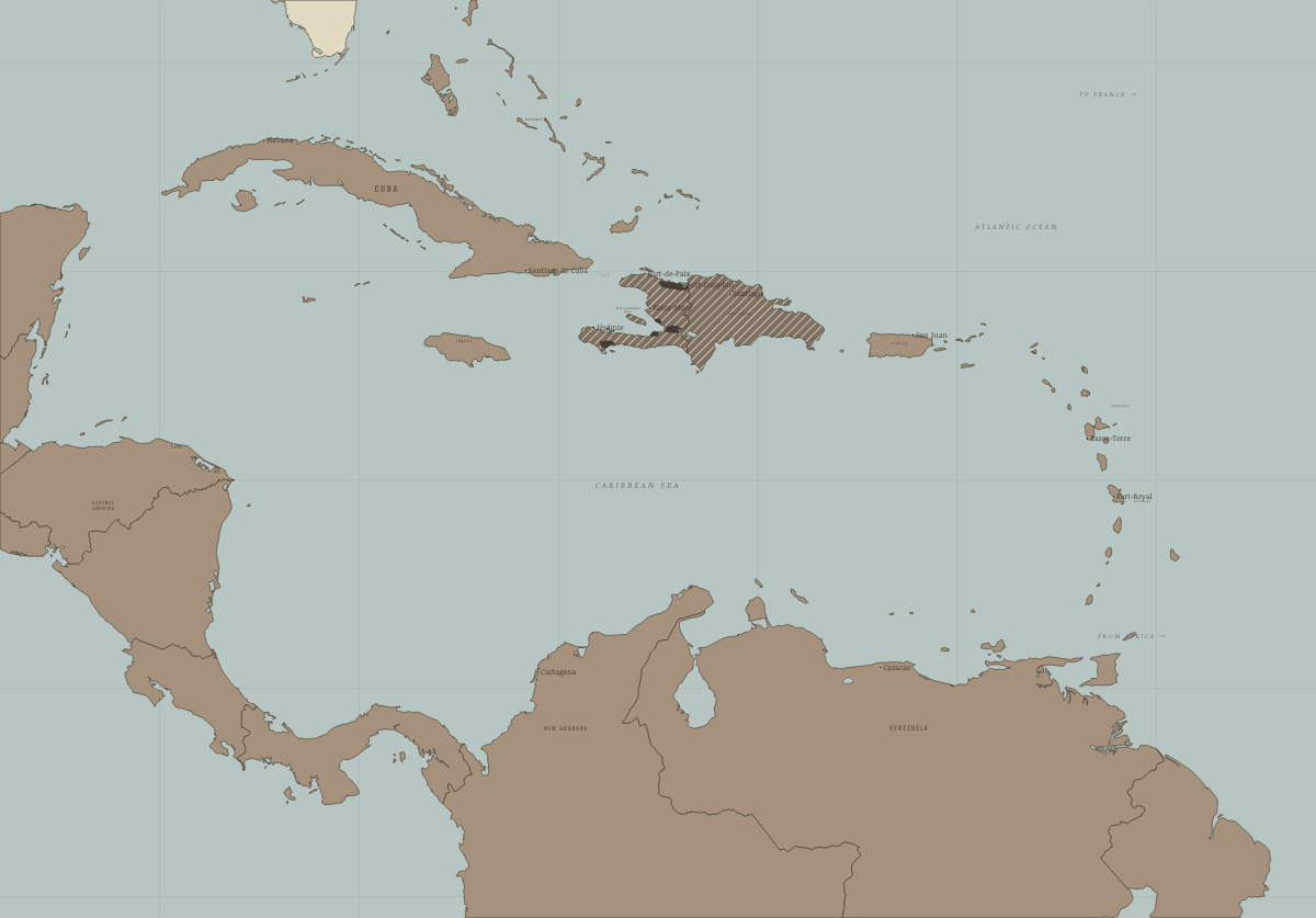
What was the Dominican Republic before it was Dominican Republic? Below, every era of this land in the Maps of History atlases — who ruled it, what it was called, and when control changed — each line linked to the dated map that shows it. Modern borders stand in as an honest approximation; every atlas says so on the map itself.
Dominican Republic · Industrial Revolution
| Colony or dependency — the opening position | |
| Agrarian economy |
INDUSTRIAL REVOLUTION: EVERY CHAPTER AND MAP →
Santo Domingo (mod. Dominican Rep.) · Age of Revolutions
| Colonial possessions — the opening position | |
| Republics & revolutionary states |
AGE OF REVOLUTIONS: EVERY CHAPTER AND MAP →
Santo Domingo (mod. Dominican Republic) · Haiti and Kenya independence
Spanish Santo Domingo, the older and poorer colony on the island’s east, lived by cattle ranching and held far fewer enslaved people than its French neighbour. Ceded to France on paper in 1795, it was taken by Toussaint in 1801, besieged by Dessalines in 1805 and ruled by Haiti from 1822 to 1844. On 27 February 1844 it declared independence as the Dominican Republic, a nation whose founding memory is freedom from Haitian rule.
| Under colonial rule — the opening position | |
| Self-rule in all but name | |
| Under colonial rule | |
| Independence won | |
| Other states and societies |
HAITI AND KENYA INDEPENDENCE: EVERY CHAPTER AND MAP →
Santo Domingo (Dominican Rep.) · American Civil War
Spain re-annexed Santo Domingo in March 1861 — weeks before Sumter, and in explicit confidence that a dividing United States could not object. The gamble failed on its own terms: the War of Restoration (1863–65) bled the Spanish out, and they left in the same summer the Confederacy died. The Dominican Republic’s second independence is a reminder that the Civil War was hemispheric weather — every empire moved while the republic was distracted, and moved back when it reunited.
| Neighbors & the outside world — the opening position |
AMERICAN CIVIL WAR: EVERY CHAPTER AND MAP →
Dominican Republic · WWI
Dominican Republic · Cold War
| US-aligned states — the opening position |
COLD WAR: EVERY CHAPTER AND MAP →
Dominican Republic · Feminism and the Tunisian Revolution
| Right won in law — the opening position | |
| No reform yet / outside this story | |
| Right won in law |
FEMINISM AND THE TUNISIAN REVOLUTION: EVERY CHAPTER AND MAP →
Related
THE FREE PRINTABLE STUDY GUIDE
Join the Dispatch — a short welcome series, then a letter when a new atlas opens — and a printable atlas study guide of your choice is yours now, free.
NO TRACKING · YOUR ADDRESS IS USED FOR THE DISPATCH AND NOTHING ELSE · UNSUBSCRIBE ANYTIME