ONE LAND · 13 ATLASES
History of Libya in maps
Libya as it appears in 13 interactive history atlases, from 264 BC to 2015: Cyrenaica & Tripolitania, Barqa & Tripolitania, Libya. Each era below lists who ruled the land and when control changed, linked to the dated map that shows it.
WW2 is free — every chapter. No sign-up.
What was Libya before it was Libya? Below, every era of this land in the Maps of History atlases — who ruled it, what it was called, and when control changed — each line linked to the dated map that shows it. Modern borders stand in as an honest approximation; every atlas says so on the map itself.
Cyrenaica & Tripolitania (mod. Libya) · Ancient Rome
Cyrenaica — Greek pentapolis bequeathed to Rome in 96 BC — and Tripolitania, Punic ports that fed Rome olive oil and gave it the Severan dynasty: Septimius Severus, the African emperor, was born at Lepcis Magna. Split by the 395 line: Tripolitania fell west with the Vandals, Cyrenaica lived east with Constantinople.
| 264 BC | Hellenistic kingdoms — the opening position |
| 62 BC | Roman territory |
ANCIENT ROME: EVERY CHAPTER AND MAP →
Barqa & Tripolitania (mod. Libya) · Crusades
| The Islamic powers — Seljuk, Zengid, Ayyubid, Mamluk — the opening position |
CRUSADES: EVERY CHAPTER AND MAP →
Libya · Industrial Revolution
| Opened by force or treaty — the opening position | |
| Opened by force or treaty | |
| Colony or dependency |
INDUSTRIAL REVOLUTION: EVERY CHAPTER AND MAP →
Libya · Age of Revolutions
| Neutral / uncommitted — the opening position |
AGE OF REVOLUTIONS: EVERY CHAPTER AND MAP →
Libya · Meiji Japan and post-Soviet Russia
MEIJI JAPAN AND POST-SOVIET RUSSIA: EVERY CHAPTER AND MAP →
Libya · WWI
Libya — the Ottoman provinces of Tripolitania and Cyrenaica until Italy invaded in 1911 (Ch. 2), in a war that saw the first bombs ever dropped from an aeroplane in combat and showed the Balkan states how weak the Ottomans had become. Italy held the coast, while in the interior the Sanusi brotherhood and Ottoman officers, among them a young Mustafa Kemal, kept fighting; Libyan resistance lasted until 1931.
Libya · Stalin’s Soviet Union
STALIN’S SOVIET UNION: EVERY CHAPTER AND MAP →
Libya · Road to WW2
| The aggressors (Japan, Germany, Italy) — the opening position |
ROAD TO WW2: EVERY CHAPTER AND MAP →
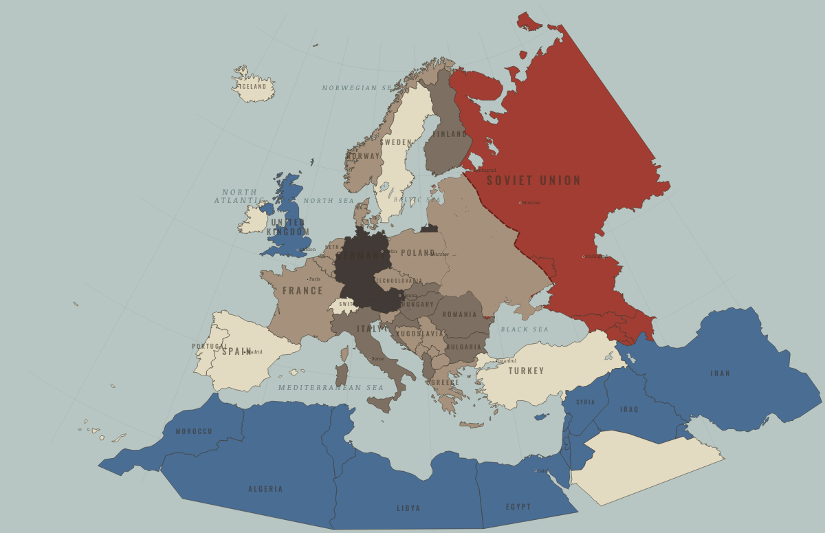
Libya · WW2
| Axis allies & puppets — the opening position | |
| Western Allies |
Libya · Cold War
| NATO & core Western allies — the opening position | |
| Non-aligned & neutral | |
| Soviet-aligned states | |
| Non-aligned & neutral | |
| Soviet-aligned states |
COLD WAR: EVERY CHAPTER AND MAP →
Libya · Decolonization of Africa
Libya, the ex-Italian colony, became the first African state to reach independence — on 24 December 1951 — not by revolt but by the vote of a United Nations that could not agree who else should hold it. A poor desert kingdom under Idris until oil transformed it, and until a young officer named Gaddafi seized power in 1969. Independence by international committee: the exception at the start of the story.
| Portuguese, Belgian, Spanish & Italian-ruled — the opening position | |
| Independent Africa |
DECOLONIZATION OF AFRICA: EVERY CHAPTER AND MAP →
Libya · Feminism and the Tunisian Revolution
Libya rose on 17 February 2011, a month after Tunisia, and Muammar Gaddafi’s regime fell in August after a civil war in which NATO intervened; he was killed in October. Hundreds of thousands of people fled into Tunisia in 2011. By 2014 Libya was divided between rival governments and militias, and Islamic State camps near Sabratha trained Tunisian recruits.
FEMINISM AND THE TUNISIAN REVOLUTION: EVERY CHAPTER AND MAP →
Libya · Refugee crises
| Western bloc or democracy — the opening position |
REFUGEE CRISES: EVERY CHAPTER AND MAP →
Related
THE FREE PRINTABLE STUDY GUIDE
Join the Dispatch — a short welcome series, then a letter when a new atlas opens — and a printable atlas study guide of your choice is yours now, free.
NO TRACKING · YOUR ADDRESS IS USED FOR THE DISPATCH AND NOTHING ELSE · UNSUBSCRIBE ANYTIME