ON THIS DAY ·
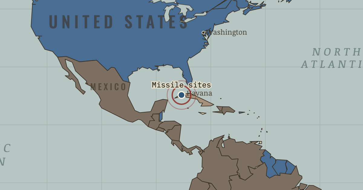
Soviet missile sites in Cuba
14 Oct 1962 — A U-2 photographs Soviet medium-range missiles at San Cristóbal — launchers that could reach Washington in minutes. The thirteen days begin.
WW2 is free — every chapter. Try chapters 1–2 of any 2 other atlases (3 with a free account). Opening a new atlas uses one of them. Membership opens all 21 — Join.
The moment in context
Cuba’s revolution drifted toward Moscow after Washington’s hostility and the botched Bay of Pigs landing of 1961 pushed it there, and Khrushchev saw in the island both a vulnerable ally worth protecting and a way to offset a heavy strategic disadvantage. Medium-range missiles, which the USSR possessed in quantity, would count as strategic weapons the moment they stood off the American coast. The plan’s fatal weakness was that it depended on a secrecy that tens of thousands of troops and hundred-foot missile trailers, spread across a photographed island, could never actually keep.
From Cuban Missile Crisis, chapter 6 of The Cold War, 1945–1991 (OCT 1962).
The place: Soviet missile sites in Cuba — map and full story →
Teach this in 5 minutes
- Why it happened — Khrushchev’s gamble: parity on the cheap. The missile gap ran against Moscow. 26 reliable Soviet ICBMs against hundreds of American bombers and missiles ringing the USSR from Turkey to…
- The turn — 27 October, aboard B-59 — one man’s no. Out of radio contact for days, batteries failing, crew fainting in 45°C heat, bracketed by practice depth charges it cannot know are signals. B-59’s…
- What it changed — The hotline and the test ban: procedure against apocalypse. Both capitals emerge shaken into sobriety: a direct teletype link (June 1963) so the next crisis can be argued in hours not days, and the Limited…
Then ask the room: Kennedy’s advisers split between airstrike and blockade. The airstrike faction lost — and later evidence suggests the airstrike would likely have triggered nuclear use. Was the outcome good judgment or good luck? The argued answer is on the chapter page →
The atlas that shows it
THE FREE PRINTABLE STUDY GUIDE
Join the Dispatch — a short welcome series, then a letter when a new atlas opens — and the printable study guide for The Cold War is yours now, free.
NO TRACKING · YOUR ADDRESS IS USED FOR THE DISPATCH AND NOTHING ELSE · UNSUBSCRIBE ANYTIME