ON THIS DAY ·
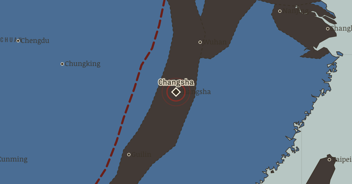
Changsha fire
13 Nov 1938 — Panicked by Wuhan’s fall, the garrison fires the city ahead of an enemy still 100 km away: some 20,000–30,000 die in the accidental inferno. The war’s waste was not all inflicted by the enemy. (Changsha then repels three Japanese offensives, 1939–42 — the war’s stubborn hinge city.)
WW2 is free — every chapter. Try chapters 1–2 of any 2 other atlases (3 with a free account). Opening a new atlas uses one of them. Membership opens all 21 — Join.
Free printable Chinese Revolution study guide, sent by email ↓
The moment in context
A points-and-lines occupation is one that controls cities and transport routes far more securely than the countryside lying between them. For six years the front barely moved, and that stillness is itself the story. The charcoal followed the cities, railways and river valleys, and between those lines Communist base areas spread across north China while government guerrillas held mountain districts. Japan stationed about a million men in China yet securely governed little beyond its garrisons. The blue interior, known as Free China, was vast, poor and besieged. Chungking (the ◆ there) was a capital bombed repeatedly while its government worked from tunnels and refused to surrender. Changsha (the ◆ there) was a city burned prematurely by its own garrison in 1938 and then defended against three Japanese offensives. The blue arrow to Lashio (the ●) is the Burma Road, 1,100 kilometers of mountain supply line that Japan cut in 1942 as Hong Kong, Burma and the Philippines turned charcoal. The Hump airlift over the Himalaya replaced part of that traffic at the cost of some 600 Allied aircraft. China was too large to conquer outright, yet geography also kept its essential supplies desperately scarce.
From Sino-Japanese War stalemate, chapter 9 of China in Revolution, 1911–1949 (1944).
The place: Changsha fire — map and full story →
Teach this in 5 minutes
- Why it happened — Why the front froze. By late 1938 Japan had outrun the arithmetic of conquest: every advance lengthened railways that guerrillas cut and garrisons bled to guard, against…
- The turn — Hengyang, June–August 1944. Choose the paradox deliberately: a heroic six-week defense, and the hinge is what its failure revealed. After Hengyang, Ichigo ran essentially…
- What it changed — The verdict of 1944 shapes 1945–46. Ichigo left the Nationalist armies wrecked and mal-deployed — their best remaining forces deep in the southwest and Burma — while the Communist base…
Then ask the room: Who fought Japan — the Nationalists, the Communists, or neither as much as each claimed? And why does the answer still matter politically? The argued answer is on the chapter page →
The atlas that shows it
THE FREE PRINTABLE STUDY GUIDE
Join the Dispatch — a short welcome series, then a letter when a new atlas opens — and the printable study guide for China in Revolution is yours now, free.
NO TRACKING · YOUR ADDRESS IS USED FOR THE DISPATCH AND NOTHING ELSE · UNSUBSCRIBE ANYTIME