ON THIS DAY ·
Christmas truce
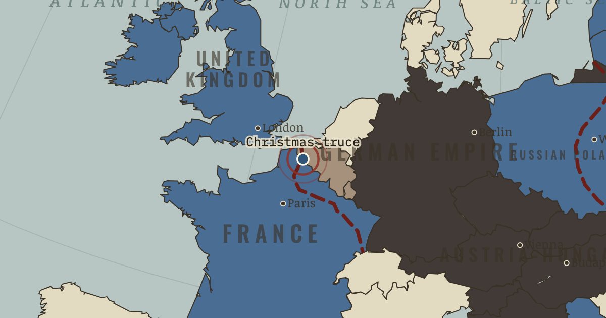
24-26 Dec 1914 — Along stretches of the line, soldiers climb out, exchange tobacco, bury their dead, and by several accounts play football. Commands on both sides make sure it never happens again.
WW2 is free — every chapter. Try chapters 1–2 of any 2 other atlases (3 with a free account). Opening a new atlas uses one of them. Membership opens all 21 — Join.
The moment in context
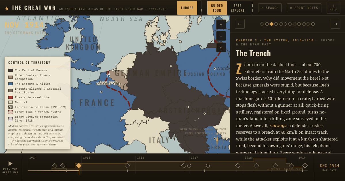
The dashed line on the map runs about seven hundred kilometres from the North Sea to the Swiss border, and it stayed almost fixed because defensive firepower had grown stronger than battlefield movement. Machine guns, barbed wire and artillery could break an exposed attack before it crossed the open ground between the trenches. Railways then allowed a defender to bring reserves to a threatened sector far faster than infantry could advance across shelled and broken earth. The combination locked the front in place for years.
From Trench warfare on the Western Front, chapter 5 of The Great War, 1871–1923 (DEC 1914).
The place: Christmas truce — map and full story →
Teach this in 5 minutes
- Why it happened — Firepower outran mobility by a generation. Between 1870 and 1914 firepower multiplied — magazine rifles, machine guns, recoil-absorbing artillery — while battlefield mobility stayed at horse…
- The turn — First Ypres, October–November 1914. The last chance of open warfare in the west dies in Flanders: the outnumbered BEF’s regulars — riflemen so fast the Germans reported machine guns —…
- What it changed — Attrition becomes the strategy. If the line cannot be broken, kill the men holding it faster than they are replaced: 1916 makes this explicit doctrine at Verdun and the Somme. The…
Then ask the room: “Lions led by donkeys” — is the contempt for First World War generals deserved? The argued answer is on the chapter page →
The atlas that shows it
THE FREE PRINTABLE STUDY GUIDE
Join the Dispatch — a short welcome series, then a letter when a new atlas opens — and the printable study guide for WWI is yours now, free.
NO TRACKING · YOUR ADDRESS IS USED FOR THE DISPATCH AND NOTHING ELSE · UNSUBSCRIBE ANYTIME