ONE LAND · 14 ATLASES
History of Jordan in maps
Jordan as it appears in 14 interactive history atlases, from 264 BC to 2015: Nabataea, Oultrejordain, Ayyubid Transjordan, Jordan, Transjordan. Each era below lists who ruled the land and when control changed, linked to the dated map that shows it.
WW2 is free — every chapter. Try chapters 1–2 of any 2 other atlases (3 with a free account). Opening a new atlas uses one of them. Membership opens all 21 — Join.
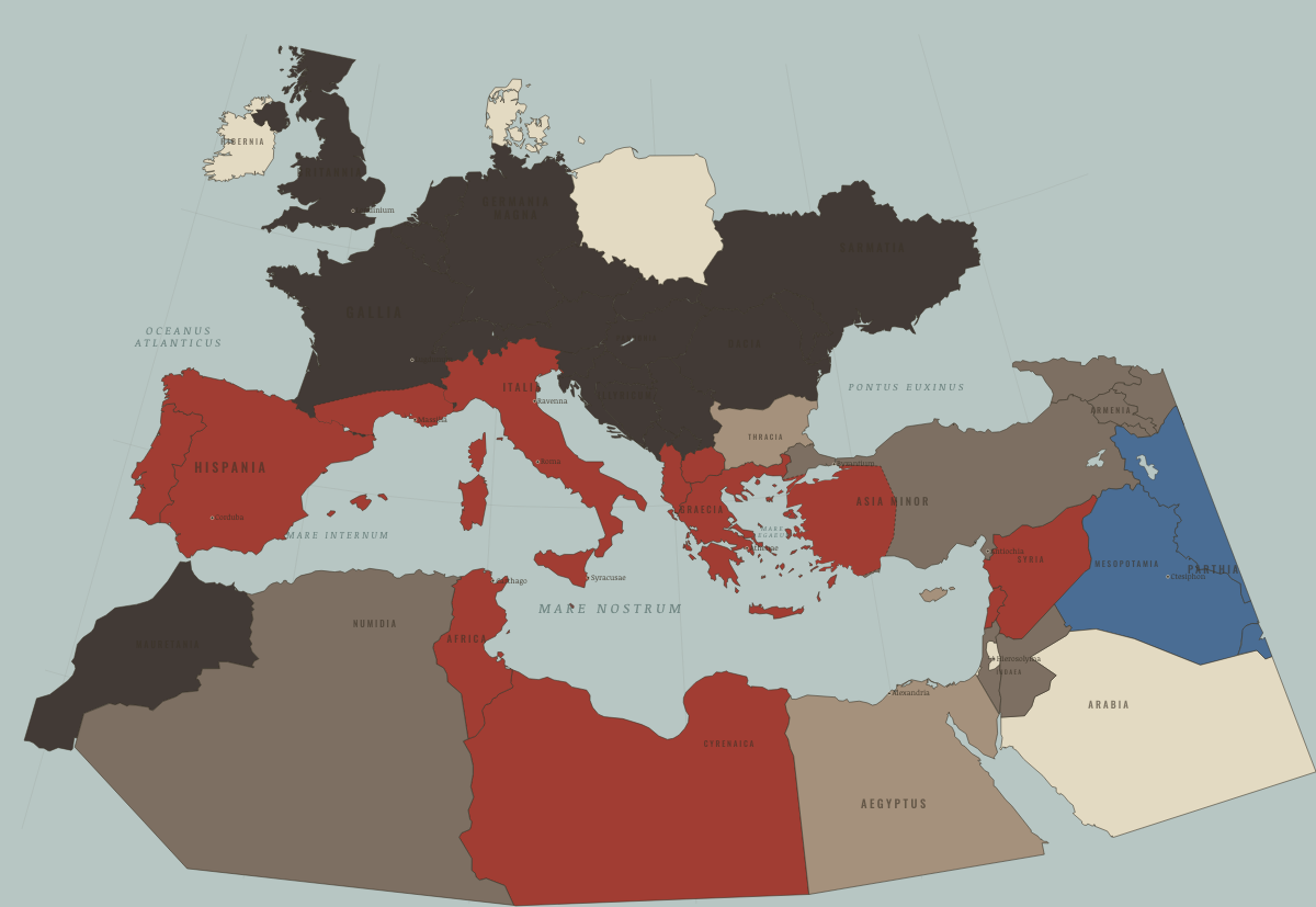
What was Jordan before it was Jordan? Below, every era of this land in the Maps of History atlases — who ruled it, what it was called, and when control changed — each line linked to the dated map that shows it. Modern borders stand in as an honest approximation; every atlas says so on the map itself.
Nabataea (mod. Jordan) · Ancient Rome
Nabataea: the caravan kingdom of Petra, rich on incense tolls — its capital carved into rose-red sandstone at the junction of the frankincense roads from Arabia. A client of Rome for 170 years (Nabataean cavalry helped Titus besiege Jerusalem), it was annexed politely as “Arabia” in AD 106, Trajan’s other, bloodless conquest; the Via Nova Traiana then paved its spine from Bostra to the Red Sea. Its desert customs posts taxed the eastern luxury trade at rates — a quarter of value, by one papyrus — that paid a surprising share of the empire’s revenue.
| 264 BC | Hellenistic kingdoms — the opening position |
| 62 BC | Roman clients & allies |
| Roman territory | |
| Breakaway Roman empires (260–274) | |
| Roman territory |
ANCIENT ROME: EVERY CHAPTER AND MAP →
Oultrejordain (mod. Jordan) · Crusades
Oultrejordain, “beyond the Jordan,” was the desert lordship guarding the caravan and army roads between Egypt and Syria. From its castles at Kerak and Montreal the notorious Reynald of Châtillon raided toward Mecca and Medina — provocations that helped harden Saladin’s resolve to destroy the kingdom that tolerated him.
| The Islamic powers — Seljuk, Zengid, Ayyubid, Mamluk — the opening position |
CRUSADES: EVERY CHAPTER AND MAP →
Ayyubid Transjordan (mod. Jordan) · Mongol Empire
| The Islamic powers — the opening position |
MONGOL EMPIRE: EVERY CHAPTER AND MAP →
Jordan · Industrial Revolution
| Opened by force or treaty — the opening position | |
| Opened by force or treaty |
INDUSTRIAL REVOLUTION: EVERY CHAPTER AND MAP →
Jordan · Age of Revolutions
| Neutral / uncommitted — the opening position |
AGE OF REVOLUTIONS: EVERY CHAPTER AND MAP →
Jordan · Meiji Japan and post-Soviet Russia
| Non-aligned or stateless — the opening position |
MEIJI JAPAN AND POST-SOVIET RUSSIA: EVERY CHAPTER AND MAP →
Transjordan (Ottoman Empire) · WWI
Jordan · Stalin’s Soviet Union
STALIN’S SOVIET UNION: EVERY CHAPTER AND MAP →
Jordan · Road to WW2
| Colonial empires & possessions — the opening position |
ROAD TO WW2: EVERY CHAPTER AND MAP →
Jordan · WW2
| Western Allies — the opening position |
Jordan · Cold War
| NATO & core Western allies — the opening position | |
| US-aligned states | |
| US-aligned states |
COLD WAR: EVERY CHAPTER AND MAP →
Jordan · Decolonization of Africa
| Independent before 1945 — the opening position |
DECOLONIZATION OF AFRICA: EVERY CHAPTER AND MAP →
Jordan · Feminism and the Tunisian Revolution
FEMINISM AND THE TUNISIAN REVOLUTION: EVERY CHAPTER AND MAP →
Jordan · Refugee crises
REFUGEE CRISES: EVERY CHAPTER AND MAP →
Related
THE FREE PRINTABLE STUDY GUIDE
Join the Dispatch — a short welcome series, then a letter when a new atlas opens — and a printable atlas study guide of your choice is yours now, free.
NO TRACKING · YOUR ADDRESS IS USED FOR THE DISPATCH AND NOTHING ELSE · UNSUBSCRIBE ANYTIME