The Great War, 1871–1923 · THE MAP IN
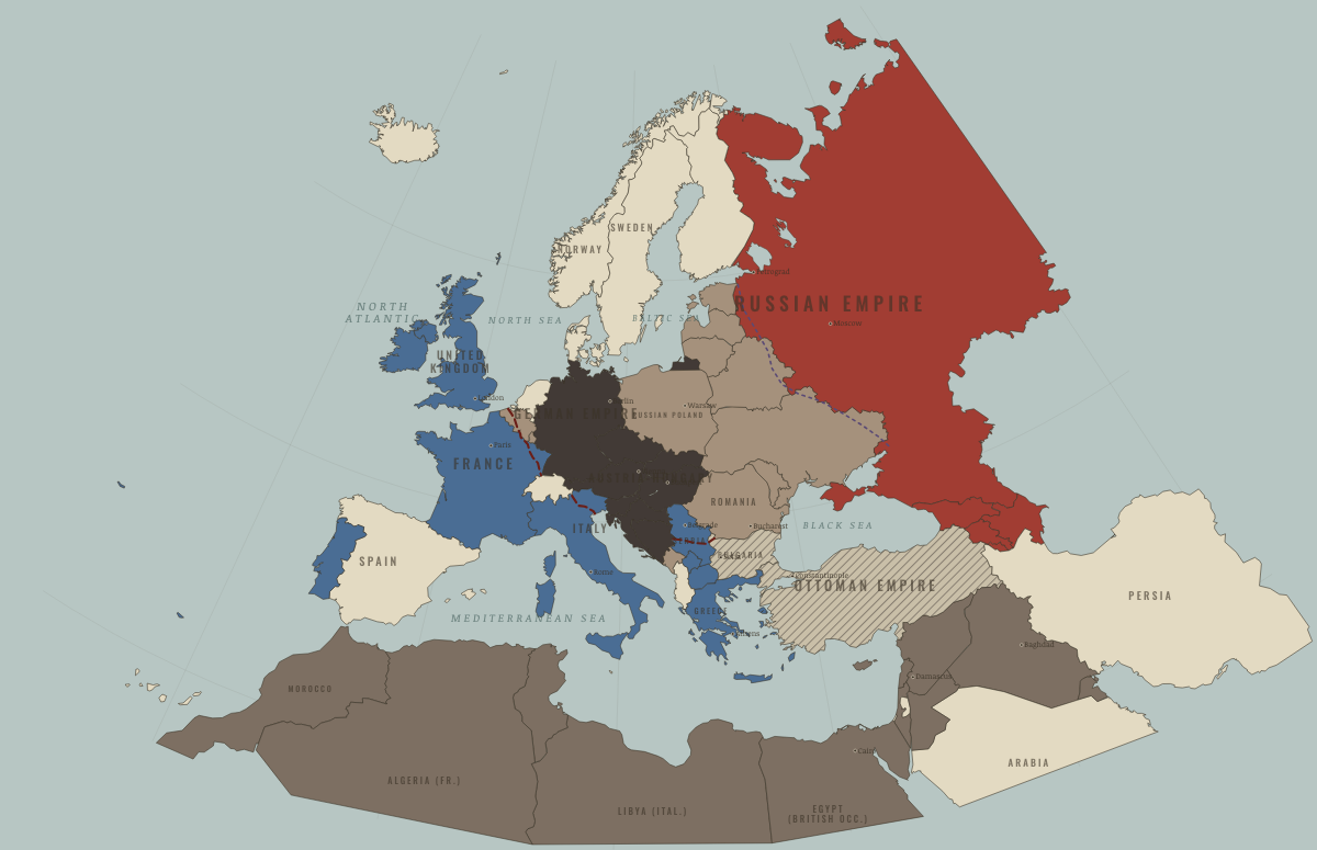
Map of Europe in October 1918
The southern wall falls · WWI
Europe in October 1918: The southern wall falls. Since July 1918, 10 territories changed status on this map: including Bulgaria, Ottoman Empire, Syria (Ottoman Empire) and 7 more.
Open this map in the interactive atlas →
WW2 is free — every chapter. Try chapters 1–2 of any 2 other atlases (3 with a free account). Opening a new atlas uses one of them. Membership opens all 21 — Join.
What changes on the map
| Bulgaria | Germany and its allies — the Central Powers → Empires in collapse (1918–22) |
| Ottoman Empire | Germany and its allies — the Central Powers → Empires in collapse (1918–22) |
| Syria (Ottoman Empire) | Germany and its allies — the Central Powers → Entente-aligned & imperial territories |
| Lebanon (Ottoman Empire) | Germany and its allies — the Central Powers → Entente-aligned & imperial territories |
| Palestine (Ottoman Empire) | Germany and its allies — the Central Powers → Entente-aligned & imperial territories |
| Transjordan (Ottoman Empire) | Germany and its allies — the Central Powers → Entente-aligned & imperial territories |
| Mesopotamia (Ottoman Empire) | Germany and its allies — the Central Powers → Entente-aligned & imperial territories |
| Serbia | Under Central Powers occupation → The Entente & Allies |
| Macedonia (Serbia) | Under Central Powers occupation → The Entente & Allies |
| Kosovo (Serbia) | Under Central Powers occupation → The Entente & Allies |
Related maps
THE FREE PRINTABLE STUDY GUIDE
Join the Dispatch — a short welcome series, then a letter when a new atlas opens — and the printable study guide for WWI is yours now, free.
NO TRACKING · YOUR ADDRESS IS USED FOR THE DISPATCH AND NOTHING ELSE · UNSUBSCRIBE ANYTIME