The Crusades, 1095–1291 · THE MAP IN
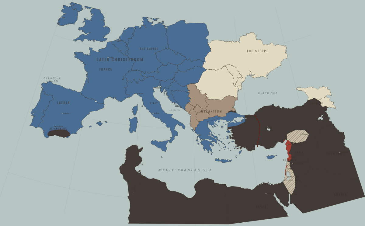
Map of the Crusades in 1212
Las Navas — Iberia shifts
The Crusades in 1212: Las Navas — Iberia shifts. The map shows who held what: Latin Christendom, The Islamic powers — Seljuk, Zengid, Ayyubid, Mamluk, Byzantium (and Latin Constantinople 1204–61).
Open this map in the interactive atlas →
WW2 is free — every chapter. Try chapters 1–2 of any 2 other atlases (3 with a free account). Opening a new atlas uses one of them. Membership opens all 21 — Join.
On the ground
- reduced to the emirate of Granada
The chapters of this moment
Related maps
THE FREE PRINTABLE STUDY GUIDE
Join the Dispatch — a short welcome series, then a letter when a new atlas opens — and the printable study guide for The Crusades is yours now, free.
NO TRACKING · YOUR ADDRESS IS USED FOR THE DISPATCH AND NOTHING ELSE · UNSUBSCRIBE ANYTIME