Uprooted: Refugees in Europe 1945–1960 and Indochina 1975–1990 · THE MAP IN
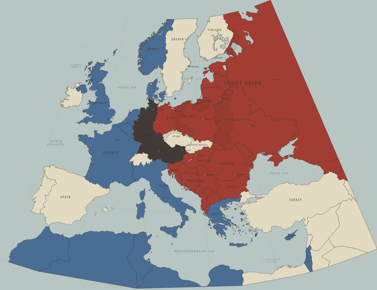
Map of refugees in Europe in August 1945
Potsdam: borders move west
Refugees in Europe in August 1945: Potsdam: borders move west. The map shows who held what: Soviet-occupied or communist, Western bloc or democracy, Germany and Austria occupied.
Open this map in the interactive atlas →
WW2 is free — every chapter. Try chapters 1–2 of any 2 other atlases (3 with a free account). Opening a new atlas uses one of them. Membership opens all 21 — Join.
On the ground
- former German Pomerania, East Brandenburg and Silesia, placed under Polish administration at Potsdam; its Germans fled or were expelled
- former East Prussia and Danzig, divided between Poland and the Soviet Union; its Germans fled or were expelled
- the British zone of occupation, 1945–49
- the French zone of occupation, 1945–49 (the Saar under a separate French regime)
- the Soviet zone of occupation, 1945–49
- the American, British and French sectors of Berlin, 1945–49
- the German-speaking borderlands of Bohemia and Moravia, emptied of about three million Germans in 1945–46
- pre-war eastern Poland, ceded to the Soviet Union in 1945; most of its Poles moved west in 1944–46
- Finnish Karelia and Salla, ceded to the Soviet Union in 1940 and 1944; almost all its people moved to Finland
The chapters of this moment
Related maps
THE FREE PRINTABLE STUDY GUIDE
Join the Dispatch — a short welcome series, then a letter when a new atlas opens — and the printable study guide for Uprooted is yours now, free.
NO TRACKING · YOUR ADDRESS IS USED FOR THE DISPATCH AND NOTHING ELSE · UNSUBSCRIBE ANYTIME