ONE LAND · 13 ATLASES
History of Syria in maps
Syria as it appears in 13 interactive history atlases, from 264 BC to 2015: Syria, Syria — Aleppo, Damascus & the states between, Ayyubid Syria. Each era below lists who ruled the land and when control changed, linked to the dated map that shows it.
WW2 is free — every chapter. No sign-up.
What was Syria before it was Syria? Below, every era of this land in the Maps of History atlases — who ruled it, what it was called, and when control changed — each line linked to the dated map that shows it. Modern borders stand in as an honest approximation; every atlas says so on the map itself.
Syria · Ancient Rome
Seleucid heartland, annexed by Pompey in 64 BC without a major battle — the Republic absorbing a great monarchy by paperwork. Antioch became the empire’s third city and the eastern command center; Palmyra’s Zenobia ruled the whole east from its edge in 270–272. Contested with Persia for four centuries; the frontier both empires bled for.
| 264 BC | Hellenistic kingdoms — the opening position |
| 62 BC | Roman territory |
| Breakaway Roman empires (260–274) | |
| Roman territory |
ANCIENT ROME: EVERY CHAPTER AND MAP →
Syria — Aleppo, Damascus & the states between · Crusades
Syria was the arena. Its rival emirates of Aleppo and Damascus were the powers the crusaders played against one another — until Zengi, Nur al-Din and finally Saladin united them into the ring that strangled Outremer. The crusader principalities of Antioch, Edessa and Tripoli were all carved from its coast and northern marches, and all were reclaimed from it.
| The Islamic powers — Seljuk, Zengid, Ayyubid, Mamluk — the opening position |
CRUSADES: EVERY CHAPTER AND MAP →
Ayyubid Syria · Mongol Empire
Ayyubid Syria was the tide’s westernmost reach: Aleppo stormed and Damascus occupied in early 1260, then everything reversed at Ain Jalut that September. For sixty years afterward Syria was the Ilkhan–Mamluk war’s frontier, raided and retaken — the map’s clearest example of a conquest that became a border.
| The Islamic powers — the opening position | |
| The Mongol Empire | |
| The Islamic powers |
MONGOL EMPIRE: EVERY CHAPTER AND MAP →
Syria · Industrial Revolution
| Opened by force or treaty — the opening position | |
| Opened by force or treaty |
INDUSTRIAL REVOLUTION: EVERY CHAPTER AND MAP →
Syria · Age of Revolutions
| Neutral / uncommitted — the opening position |
AGE OF REVOLUTIONS: EVERY CHAPTER AND MAP →
Syria · Meiji Japan and post-Soviet Russia
| Non-aligned or stateless — the opening position |
MEIJI JAPAN AND POST-SOVIET RUSSIA: EVERY CHAPTER AND MAP →
Syria (Ottoman Empire) · WWI
Ottoman Syria endured the war as famine — the blockade, locusts and requisition killed perhaps half a million in greater Syria — then greeted Faisal’s Arab army and the promise of independence in 1918 (Ch. 12). The French mandate arrived instead, by force, at Maysalun in 1920: Sykes–Picot (Ch. 9) outlived every promise that contradicted it.
Syria · Stalin’s Soviet Union
STALIN’S SOVIET UNION: EVERY CHAPTER AND MAP →
Syria · Road to WW2
| Colonial empires & possessions — the opening position |
ROAD TO WW2: EVERY CHAPTER AND MAP →
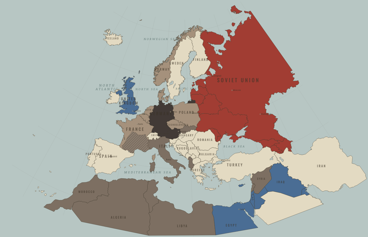
Syria · WW2
| Western Allies — the opening position | |
| Axis allies & puppets | |
| Western Allies |
Syria · Cold War
| NATO & core Western allies — the opening position | |
| Non-aligned & neutral | |
| Soviet-aligned states | |
| Non-aligned & neutral | |
| Soviet-aligned states |
COLD WAR: EVERY CHAPTER AND MAP →
Syria · Feminism and the Tunisian Revolution
| Refused: women excluded; ERA never ratified — the opening position | |
| Right won in law | |
| No reform yet / outside this story |
FEMINISM AND THE TUNISIAN REVOLUTION: EVERY CHAPTER AND MAP →
Syria · Refugee crises
REFUGEE CRISES: EVERY CHAPTER AND MAP →
Related
THE FREE PRINTABLE STUDY GUIDE
Join the Dispatch — a short welcome series, then a letter when a new atlas opens — and a printable atlas study guide of your choice is yours now, free.
NO TRACKING · YOUR ADDRESS IS USED FOR THE DISPATCH AND NOTHING ELSE · UNSUBSCRIBE ANYTIME