ON THIS DAY ·
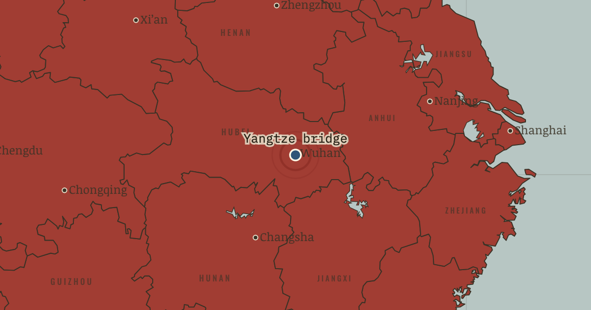
Wuhan Yangtze River Bridge
15 Oct 1957 — The first bridge over the Yangtze, built in two years with Soviet engineers, joins the Beijing and Guangzhou railways into one line; until then every train between north and south crossed by ferry. Mao swam the river below its unfinished piers in June 1956 and wrote a poem about the bridge.
WW2 is free — every chapter. Try chapters 1–2 of any 2 other atlases (3 with a free account). Opening a new atlas uses one of them. Membership opens all 21 — Join.
The moment in context
The Soviet Union was the only model China’s leaders trusted, and after the Korean War it was the only one available. Its model was central planning, in which ministries set every factory’s output much as a head office sets targets for each branch of a company, and China copied it in the First Five-Year Plan of 1953–57. An American-led embargo, a ban on trade with China, had closed off Western technology, while Moscow offered designs, machines and about 10,000 specialists over the decade. The north-east received the showpieces because it had the Japanese-built industrial base and lay nearest the Soviet railway, which the arrows follow to Harbin and Anshan. Anshan’s steelworks was rebuilt, and in Changchun the First Automobile Works produced China’s first truck in 1956. The Plan also placed new plants inland, at Wuhan, Baotou, Lanzhou and Xi’an, away from the vulnerable coast. Because the model fitted the alliance, China adopted it with little debate.
From China’s First Five-Year Plan, chapter 4 of The People’s Republic under Mao, 1949–1976 (1956).
The place: Wuhan Yangtze River Bridge — map and full story →
Teach this in 5 minutes
- Why it happened — The war closed every other door. The Korean War left China under an American trade embargo and dependent on Soviet weapons, loans and advice. With Western technology out of reach,…
- The turn — The “high tide”, July 1955. Mao’s speech of 31 July 1955 is the hinge of the Plan years because it took the pace of change away from the planners and gave it to the campaign.…
- What it changed — The Leap forward from the Plan. The Plan succeeded in industry and left agriculture lagging, and Mao concluded that the Soviet model was too slow and too bureaucratic for China.…
Then ask the room: Was the First Five-Year Plan a success, and for whom? The argued answer is on the chapter page →
The atlas that shows it
THE FREE PRINTABLE STUDY GUIDE
Join the Dispatch — a short welcome series, then a letter when a new atlas opens — and the printable study guide for The People’s Republic under Mao is yours now, free.
NO TRACKING · YOUR ADDRESS IS USED FOR THE DISPATCH AND NOTHING ELSE · UNSUBSCRIBE ANYTIME