ON THIS DAY ·
Battle of the Falkland Islands
8 Dec 1914 — Von Spee’s cruiser squadron, having destroyed a British force at Coronel, is caught coaling by battlecruisers and annihilated. The oceans belong to the Allies; Germany’s surface war outside the North Sea is over in four months.
WW2 is free — every chapter. Try chapters 1–2 of any 2 other atlases (3 with a free account). Opening a new atlas uses one of them. Membership opens all 21 — Join.

The moment in context
The war became global because the European powers ruled empires, and those empires supplied the men and materials that kept the fighting going. Millions of soldiers, labourers and porters from Africa, Asia, the Pacific and the Americas sustained campaigns they had never chosen to join. India furnished the largest volunteer army yet raised, while the deaths of African porters were enormous but poorly recorded. Japan seized German possessions in China and the Pacific at little cost to itself, and imperial forces fought long campaigns across Africa.
From WWI outside Europe, chapter 9 of The Great War, 1871–1923 (MAY 1917).
The place: Battle of the Falkland Islands — map and full story →
Teach this in 5 minutes
- Why it happened — Empires wage war with empires. Why was a European war global on day one? Because its belligerents were not countries but systems: shipping lanes, coaling stations, colonial…
- The turn — The double promise, 1916. Between January and May 1916, Britain committed itself to Arab independence and to partition with France over the same territory. It is this atlas’s…
- What it changed — The empires lose their aura. A generation of colonial soldiers saw Europeans die badly, take orders, and depend on colonial labor and loyalty. Wilson’s “self-determination” and…
Then ask the room: “A European civil war with global casualties” — is that a fair description of 1914–18? The argued answer is on the chapter page →
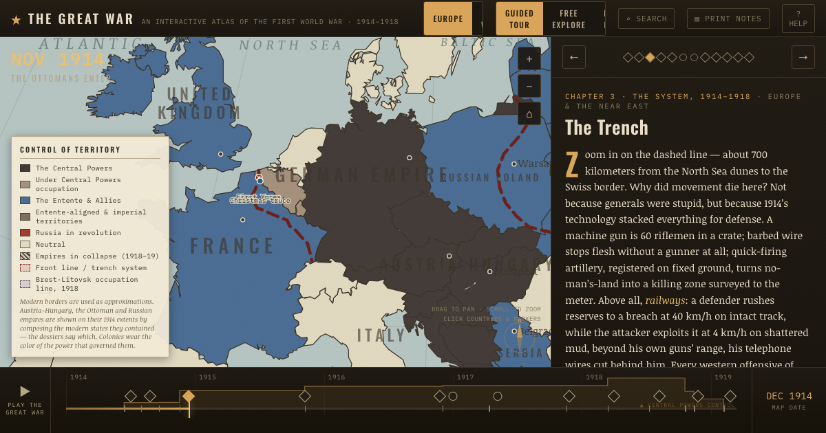
The atlas that shows it
THE FREE PRINTABLE STUDY GUIDE
Join the Dispatch — a short welcome series, then a letter when a new atlas opens — and the printable study guide for WWI is yours now, free.
NO TRACKING · YOUR ADDRESS IS USED FOR THE DISPATCH AND NOTHING ELSE · UNSUBSCRIBE ANYTIME