China in Revolution, 1911–1949
Chinese Revolution maps by year
18 historical maps of China in Revolution, 1911–1949, one for each turning point: who controlled what, and what changed since the map before.
Explore every date in the interactive atlas →
WW2 is free — every chapter. Try chapters 1–2 of any 2 other atlases (3 with a free account). Opening a new atlas uses one of them. Membership opens all 21 — Join.
Free printable Chinese Revolution study guide, sent by email ↓
China

1912
THE ABDICATION — THE EDGES BREAK AWAY
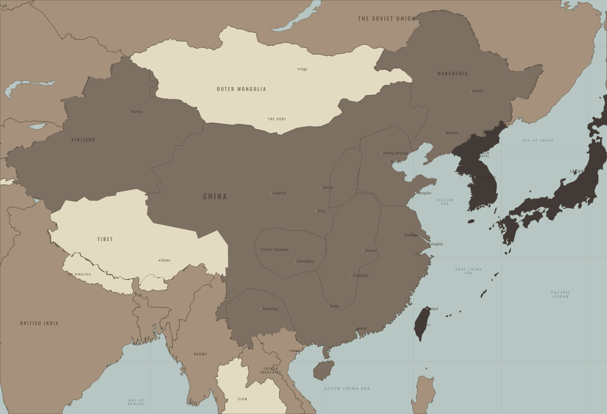
1916
YUAN DIES — THE WARLORD FRACTURE

1923
THE WARLORD WARS — CANTON ORGANIZES

1927
THE NORTHERN EXPEDITION AT THE YANGTZE

1928
PEKING TAKEN — NOMINAL REUNIFICATION

1931
MUKDEN — AND THE CHINESE SOVIET REPUBLIC

1933
MANCHUKUO AND THE TANGGU TRUCE

1934
THE FIFTH ENCIRCLEMENT — BREAKOUT

1935
THE MARCH ENDS AT YAN’AN

1937
PEKING, SHANGHAI, NANJING FALL

1938
WUHAN AND CANTON — THE STALEMATE LINE

1942
THE WIDER WAR — THE LIFELINES CUT

1944
ICHIGO — POINTS AND LINES

1945
SURRENDER — THE LIBERATED AREAS

1947
YAN’AN FALLS — THE GOVERNMENT’S HIGH TIDE

1948
LIAOSHEN AND HUAIHAI — THE NORTH GOES RED

1949
PINGJIN — THE ARMIES FACE THE YANGTZE

October 1949
THE PEOPLE’S REPUBLIC
Historical maps from every atlas, by year →
THE FREE PRINTABLE STUDY GUIDE
Join the Dispatch — a short welcome series, then a letter when a new atlas opens — and the printable study guide for China in Revolution is yours now, free.
NO TRACKING · YOUR ADDRESS IS USED FOR THE DISPATCH AND NOTHING ELSE · UNSUBSCRIBE ANYTIME