Climate and Innovation: The Norse and the Aztecs, c. 790–1521 · THE MAP AROUND
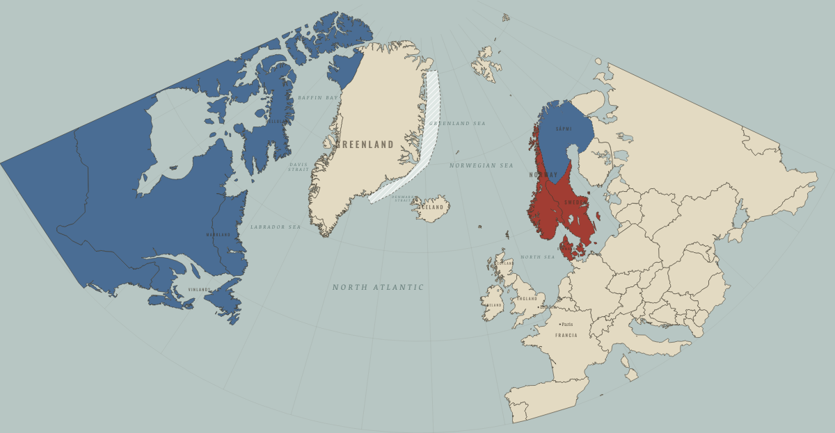
Map of the Norse North Atlantic around 790
Scandinavia on the eve of the Viking Age
The Norse North Atlantic around 790: Scandinavia on the eve of the Viking Age. The map shows who held what: Indigenous peoples of the North, Norse homelands & settlements.
WW2 is free — every chapter. Try chapters 1–2 of any 2 other atlases (3 with a free account). Opening a new atlas uses one of them. Membership opens all 21 — Join.
Free printable Norse and Aztecs study guide, sent by email ↓
On the ground
- Sápmi — the lands of the Sámi, herders and hunters who paid tribute in furs and hides to Norse chieftains such as Ohthere
Related maps
THE FREE PRINTABLE STUDY GUIDE
Join the Dispatch — a short welcome series, then a letter when a new atlas opens — and the printable study guide for Climate and Innovation is yours now, free.
NO TRACKING · YOUR ADDRESS IS USED FOR THE DISPATCH AND NOTHING ELSE · UNSUBSCRIBE ANYTIME