The Great War, 1871–1923 · THE MAP IN
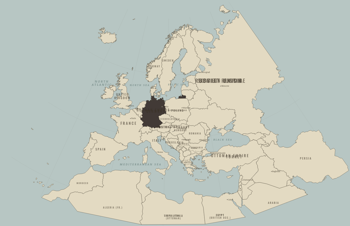
Map of Europe in May 1871
A new empire in the middle · before WWI
Europe in May 1871: A new empire in the middle. The map shows who held what: Germany and its allies — the Central Powers.
Open this map in the interactive atlas →
WW2 is free — every chapter. Try chapters 1–2 of any 2 other atlases (3 with a free account). Opening a new atlas uses one of them. Membership opens all 21 — Join.
On the ground
- Alsace-Lorraine, annexed by the German Empire in 1871 and returned to France in 1918
- Ottoman until 1878, when Bulgaria became an autonomous principality; the far south stayed Ottoman until 1912
- Ottoman until 1878, then occupied by Austria-Hungary
- Ottoman until 1878 (Niš, Pirot, Vranje) or 1912 (the Sanjak)
- Ottoman until Montenegro took it in 1878
- Ottoman until Montenegro took it in 1878–80
- northern Dobruja, Ottoman until 1878, then Romanian
- Thessaly and Arta, Ottoman until 1881; the north of today’s Greece and the islands until 1912–13
- still under Ottoman rule (striped) until the Balkan Wars of 1912–13
- Crete and the eastern Aegean islands, Ottoman until 1912–13
Related maps
THE FREE PRINTABLE STUDY GUIDE
Join the Dispatch — a short welcome series, then a letter when a new atlas opens — and the printable study guide for WWI is yours now, free.
NO TRACKING · YOUR ADDRESS IS USED FOR THE DISPATCH AND NOTHING ELSE · UNSUBSCRIBE ANYTIME