Remaking the State: Meiji Japan 1600–1912 and Post-Soviet Russia 1964–2000 · THE MAP IN
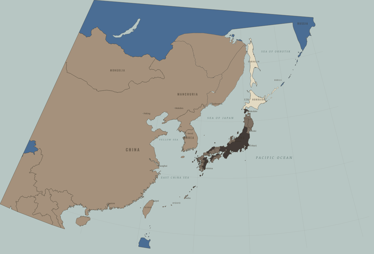
Map of Japan in 1840
Tokugawa Japan before the Opium War
Japan in 1840: Tokugawa Japan before the Opium War. The map shows who held what: Independent neighbours, Western powers and allies, The shogun’s lands and allies.
WW2 is free — every chapter. Try chapters 1–2 of any 2 other atlases (3 with a free account). Opening a new atlas uses one of them. Membership opens all 21 — Join.
Free printable Meiji Japan and post-Soviet Russia study guide, sent by email ↓
On the ground
- a patchwork of some 260 domains: charcoal the shogun’s own lands and loyal houses, grey-tan the outer lords on the rim
- the domains survive under the emperor until 1871; red marks the former shogunal lands ruled directly from Tokyo
- Outer Manchuria, Qing territory until the treaties of Aigun (1858) and Peking (1860)
- the Ussuri coast, held jointly from 1858 and Russian from 1860, when Vladivostok was founded
- Sakhalin: Ainu, Nivkh and Uilta lands claimed by Japan and Russia, left undivided in 1855 and Russian from 1875
- Ezo: the Ainu homeland, its trade monopolised by the Matsumae domain; renamed Hokkaido and colonised from 1869
- the southern Kurils, Ainu islands under Japanese administration; the 1855 Treaty of Shimoda set the border north of Etorofu
- the Ryukyu kingdom, vassal of Satsuma and tributary of China, annexed as Okinawa Prefecture in 1879
Related maps
THE FREE PRINTABLE STUDY GUIDE
Join the Dispatch — a short welcome series, then a letter when a new atlas opens — and the printable study guide for Remaking the State is yours now, free.
NO TRACKING · YOUR ADDRESS IS USED FOR THE DISPATCH AND NOTHING ELSE · UNSUBSCRIBE ANYTIME