The American Civil War, 1840–1877 · THE MAP IN
Map of North America in 1840
A continent of rival claims
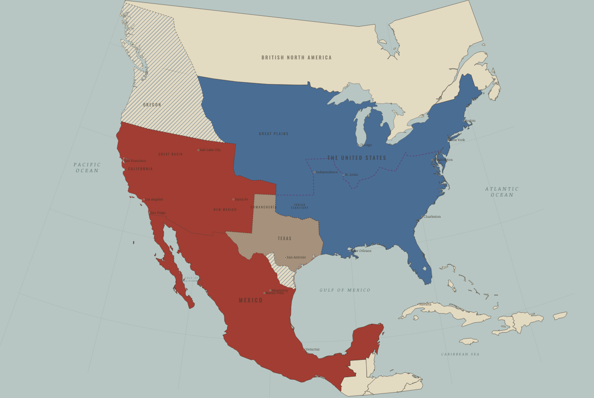
North America in 1840: A continent of rival claims. The map shows who held what: The Union, Mexico, 1840–54.
Open this map in the interactive atlas →
WW2 is free — every chapter. Try chapters 1–2 of any 2 other atlases (3 with a free account). Opening a new atlas uses one of them. Membership opens all 21 — Join.
Free printable American Civil War study guide, sent by email ↓
On the ground
- Mexico’s far north — Alta California and Nuevo México, beyond the Adams–Onís line, the US–Spanish border treaty of 1819; claimed from Mexico City, held in fact by Comanche, Apache, Navajo and Ute nations as much as by Mexican settlers
- the Republic of Texas — independent since 1836, a slaveholding republic recognised by the United States in 1837 but never by Mexico
- the Nueces strip — Texas claimed the Rio Grande, Mexico the Nueces; Taylor’s army marched into it in March 1846 and the war began here
- the Oregon Country west of the Rockies — jointly occupied by Britain and the United States from 1818 until the 49th-parallel treaty of 15 June 1846
Related maps
THE FREE PRINTABLE STUDY GUIDE
Join the Dispatch — a short welcome series, then a letter when a new atlas opens — and the printable study guide for The American Civil War is yours now, free.
NO TRACKING · YOUR ADDRESS IS USED FOR THE DISPATCH AND NOTHING ELSE · UNSUBSCRIBE ANYTIME