ONE LAND · 11 ATLASES
History of Afghanistan in maps
Afghanistan as it appears in 11 interactive history atlases, from 1206 to 2000: Herat, Balkh & Ghur, Afghanistan. Each era below lists who ruled the land and when control changed, linked to the dated map that shows it.
WW2 is free — every chapter. Try chapters 1–2 of any 2 other atlases (3 with a free account). Opening a new atlas uses one of them. Membership opens all 21 — Join.
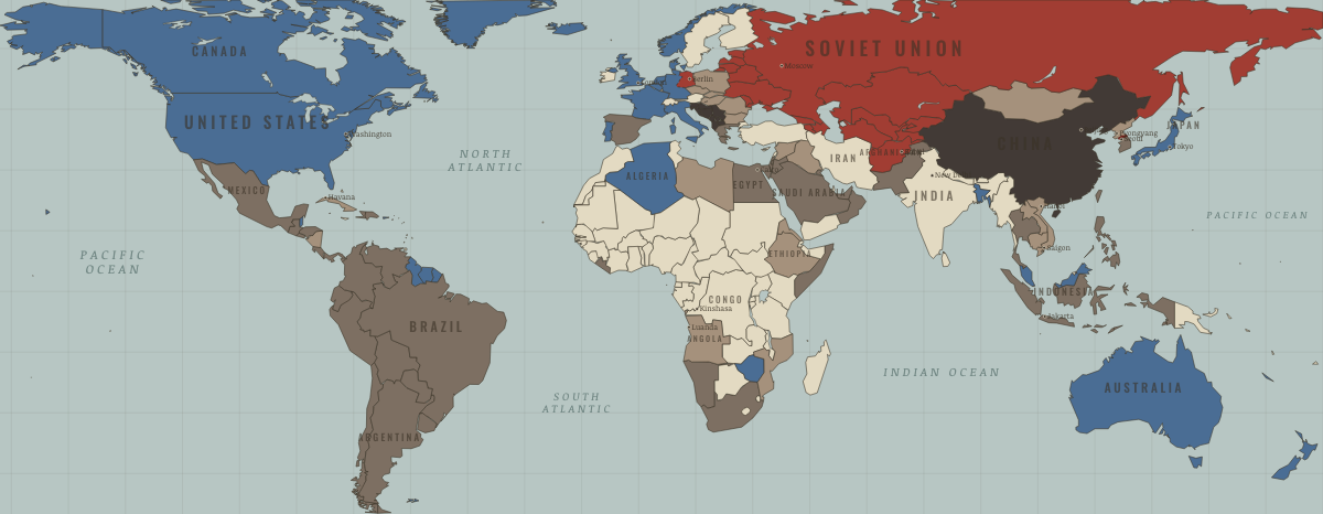
What was Afghanistan before it was Afghanistan? Below, every era of this land in the Maps of History atlases — who ruled it, what it was called, and when control changed — each line linked to the dated map that shows it. Modern borders stand in as an honest approximation; every atlas says so on the map itself.
Herat, Balkh & Ghur (mod. Afghanistan) · Mongol Empire
Herat, Balkh and Ghur — Khorasan’s eastern rim — suffered the campaign’s worst systematic destruction (Balkh razed 1221, Herat massacred after revolt in 1222), and Bamiyan’s valley was reportedly annihilated for the death of the khan’s grandson. The region’s cities took generations to recover; some qanat systems never did.
| The Islamic powers — the opening position | |
| The Mongol Empire |
MONGOL EMPIRE: EVERY CHAPTER AND MAP →
Afghanistan · Industrial Revolution
INDUSTRIAL REVOLUTION: EVERY CHAPTER AND MAP →
Afghanistan · Meiji Japan and post-Soviet Russia
Afghanistan appears on the Eurasia map as the Soviet Union’s last war. A communist coup in 1978 provoked revolt, and the invasion of December 1979 began a war in which between about half a million and 2 million Afghans died, many estimates putting it near a million, and about 5 million fled to Pakistan and Iran. Soviet troops left in February 1989, the communist government fell in 1992, and civil war continued through the decade, hatched on every map.
| Non-aligned or stateless — the opening position | |
| War, rebellion, breakaway |
MEIJI JAPAN AND POST-SOVIET RUSSIA: EVERY CHAPTER AND MAP →
Afghanistan · Russian Revolution
Afghanistan won full independence from Britain in 1919 and became one of the first states to recognize Soviet Russia — a buffer kingdom courted by Moscow as a lever against the British Empire in Asia.
| Neutral or independent — the opening position |
RUSSIAN REVOLUTION: EVERY CHAPTER AND MAP →
Afghanistan (independent 1919) · Indian independence
The buffer state that broke free first: nominally sovereign but British-steered since 1880, Afghanistan attacked across the Durand Line in May 1919 amid the Punjab’s convulsions, and at Rawalpindi in August won the thing that mattered — its own foreign policy. Watch this map’s northwest corner turn red in 1919, twenty-eight years before anything else moves. Kabul then spent the era as a listening post between empires — and after 1947 inherited the Durand Line dispute with Pakistan that runs to this day.
| Beyond the Raj · Portuguese & French India — the opening position | |
| Self-rule / independent |
INDIAN INDEPENDENCE: EVERY CHAPTER AND MAP →
Afghanistan · WWI
Afghanistan · Chinese Revolution
The buffer that stayed a buffer. Afghanistan spends the era as the one state on the map’s western edge belonging to no empire — having fought Britain to a treaty in 1919 — and its neutrality through the world war is a small masterpiece of survival diplomacy between the Soviet north and British south. From Kabul the Chinese catastrophe is a distant rumor; the two countries’ shared sliver of border, up the Wakhan corridor, is the quietest line on this entire map.
| Neutral / de-facto independent — the opening position |
CHINESE REVOLUTION: EVERY CHAPTER AND MAP →
Afghanistan · Stalin’s Soviet Union
STALIN’S SOVIET UNION: EVERY CHAPTER AND MAP →
Afghanistan · Road to WW2
| Neutral & unaligned — the opening position |
ROAD TO WW2: EVERY CHAPTER AND MAP →
Afghanistan · Cold War
The empire’s last war: invaded in 1979 to save a client regime, held nine years against a CIA- and Saudi-funded, Pakistani-run resistance, abandoned in 1989 (Ch. 10). A million or more Afghans died; the Soviet state’s self-belief died with them. The weapons and networks the war built became the next era’s problem — presented to every sponsor in turn.
| USSR & Warsaw Pact — the opening position | |
| USSR & Warsaw Pact | |
| Soviet-aligned states | |
| Non-aligned & neutral |
COLD WAR: EVERY CHAPTER AND MAP →
Afghanistan · Mao’s China
| Neutral, non-aligned or colonial — the opening position |
MAO’S CHINA: EVERY CHAPTER AND MAP →
Related
THE FREE PRINTABLE STUDY GUIDE
Join the Dispatch — a short welcome series, then a letter when a new atlas opens — and a printable atlas study guide of your choice is yours now, free.
NO TRACKING · YOUR ADDRESS IS USED FOR THE DISPATCH AND NOTHING ELSE · UNSUBSCRIBE ANYTIME