ONE LAND · 9 ATLASES
History of the Philippines in maps
The Philippines as it appears in 9 interactive history atlases, from 1750 to 2000: the Philippines, Philippines. Each era below lists who ruled the land and when control changed, linked to the dated map that shows it.
WW2 is free — every chapter. No sign-up.
What was the Philippines before it was Philippines? Below, every era of this land in the Maps of History atlases — who ruled it, what it was called, and when control changed — each line linked to the dated map that shows it. Modern borders stand in as an honest approximation; every atlas says so on the map itself.
The Philippines (Spanish; American from 1898) · Industrial Revolution
| Colony or dependency — the opening position |
INDUSTRIAL REVOLUTION: EVERY CHAPTER AND MAP →
The Philippines · Meiji Japan and post-Soviet Russia
| Western powers and allies — the opening position |
MEIJI JAPAN AND POST-SOVIET RUSSIA: EVERY CHAPTER AND MAP →
Philippines · WWI
The Philippines (American) · Chinese Revolution
The American colony across the sea: promised independence on a schedule (1935 commonwealth, 1946 republic) that made it the era’s test of whether empires could exit gracefully. Japan’s 1941–45 occupation interrupts with a brutality Manila shares with China’s cities; the guerrilla war that answers it includes the Hukbalahap — peasant, communist-led, schooled in the same doctrines circulating from Yan’an. Independence arrives in 1946 with the Huks excluded from its politics; their rebellion into the 1950s is the Chinese revolution’s echo offshore.
| Foreign empires — British, French, Russian, American — the opening position | |
| The Empire of Japan & its puppets | |
| Foreign empires — British, French, Russian, American |
CHINESE REVOLUTION: EVERY CHAPTER AND MAP →
The Philippines (US Commonwealth) · Road to WW2
| Colonial empires & possessions — the opening position |
ROAD TO WW2: EVERY CHAPTER AND MAP →
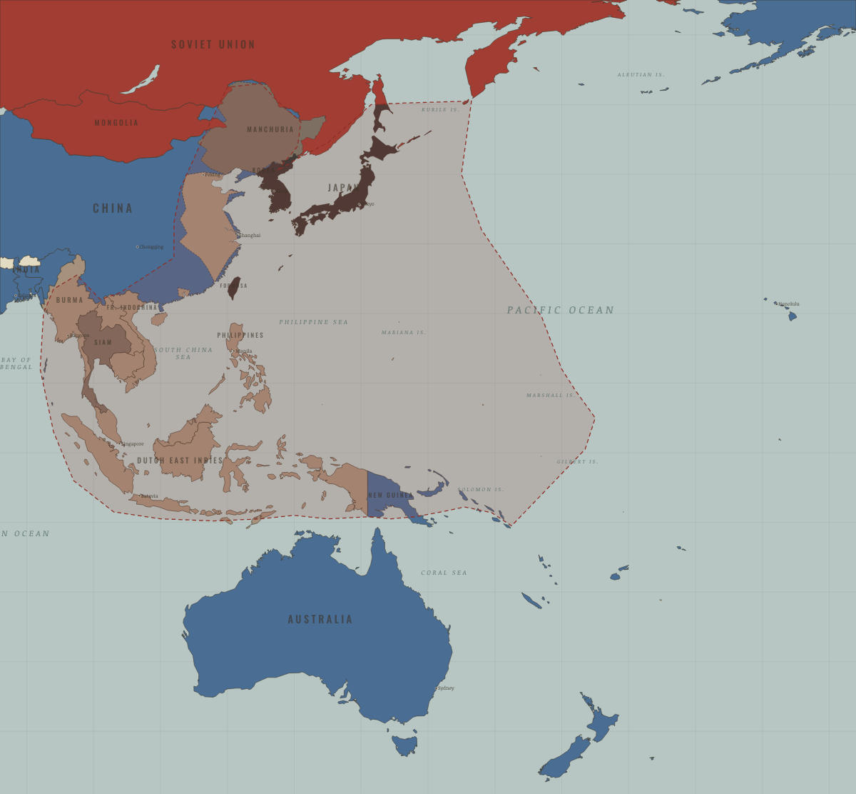
Philippines · WW2
American colony promised independence; overrun by Japan in 1942 (Bataan death march), site of MacArthur’s promised return at Leyte (1944) and the devastating Battle of Manila. Independent 1946 — the first domino of postwar decolonization.
| Western Allies — the opening position | |
| Axis-occupied | |
| Western Allies |
Philippines · Cold War
| NATO & core Western allies — the opening position | |
| US-aligned states |
COLD WAR: EVERY CHAPTER AND MAP →
Philippines · Refugee crises
The Philippines hosted American evacuees at Subic Bay in 1975, a first-asylum camp on Palawan from 1979 and, from 1980, the Refugee Processing Center at Bataan, where more than 400,000 people learned English before going to the United States. In 1981 it became the only state of first asylum in the region to accede to the Refugee Convention.
| Western bloc or democracy — the opening position | |
| First asylum open | |
| First asylum restricted | |
| First asylum open |
REFUGEE CRISES: EVERY CHAPTER AND MAP →
The Philippines · Mao’s China
| Beijing’s adversaries — the opening position | |
| Neutral, non-aligned or colonial |
MAO’S CHINA: EVERY CHAPTER AND MAP →
Related
THE FREE PRINTABLE STUDY GUIDE
Join the Dispatch — a short welcome series, then a letter when a new atlas opens — and a printable atlas study guide of your choice is yours now, free.
NO TRACKING · YOUR ADDRESS IS USED FOR THE DISPATCH AND NOTHING ELSE · UNSUBSCRIBE ANYTIME