ON THIS DAY ·
Meeting of Moctezuma and Cortés
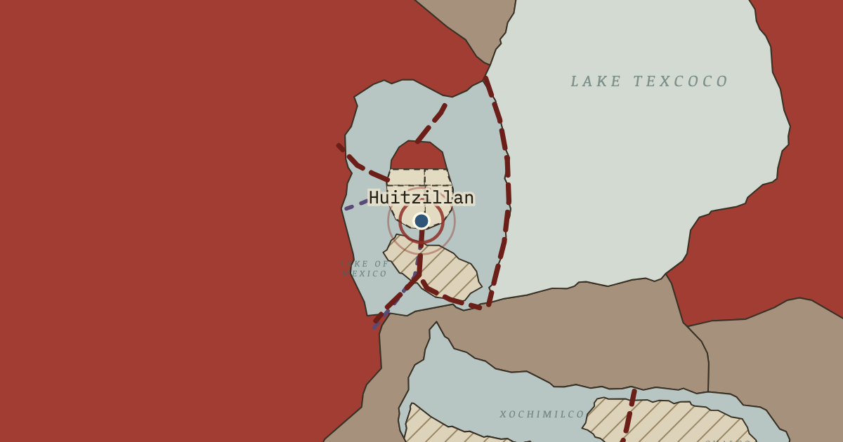
8 November 1519 — Moctezuma II came out with his nobles to meet Hernán Cortés at Huitzillan, near where the southern causeway entered the city, and lodged the Spaniards in a palace beside the sacred precinct. Their astonished accounts describe the city at its height.
WW2 is free — every chapter. Try chapters 1–2 of any 2 other atlases (3 with a free account). Opening a new atlas uses one of them. Membership opens all 21 — Join.
Free printable Norse and Aztecs study guide, sent by email ↓
The moment in context
The city’s layout expressed a religious idea and solved practical problems at the same time. At its centre stood the sacred precinct, roughly 430–460 metres across, where the friar Bernardino de Sahagún’s informants listed 78 structures, dominated by the Templo Mayor, a pyramid with twin shrines to Huitzilopochtli, god of war and the sun, and Tlaloc, god of rain. Excavations led by Eduardo Matos Moctezuma since 1978 show that the temple was enlarged in seven major building stages. The causeways leading north, west and south divided the island into four quarters, Moyotlan, Teopan, Atzacoalco and Cuepopan, and each was split into neighbourhoods called calpolli, about seventy in all. A calpolli worked much like a modern borough, with its own temple, school and local officials, so the city could be governed in manageable units.
From Layout of Tenochtitlan, chapter 10 of Climate and Innovation: The Norse and the Aztecs, c. 790–1521 (1519).
The place: Meeting of Moctezuma and Cortés — map and full story →
Teach this in 5 minutes
- Why it happened — Life on water demanded planning. A city on islands in a shallow lake could not grow haphazardly, because every new house lot had to be built up from the lake bed and connected to…
- The turn — Huitzillan, 8 November 1519. The meeting of Moctezuma II and Hernán Cortés at the edge of the city on 8 November 1519 is the hinge of this chapter because it is the moment the…
- What it changed — A city the Spaniards would rebuild on. After the conquest the Spaniards built Mexico City on the ruins of Tenochtitlan, keeping the main causeways as streets and placing the cathedral and…
Then ask the room: Was Tenochtitlan’s plan primarily a solution to environmental problems or an expression of political and religious power? The argued answer is on the chapter page →
The atlas that shows it
THE FREE PRINTABLE STUDY GUIDE
Join the Dispatch — a short welcome series, then a letter when a new atlas opens — and the printable study guide for Climate and Innovation is yours now, free.
NO TRACKING · YOUR ADDRESS IS USED FOR THE DISPATCH AND NOTHING ELSE · UNSUBSCRIBE ANYTIME