ON THIS DAY ·
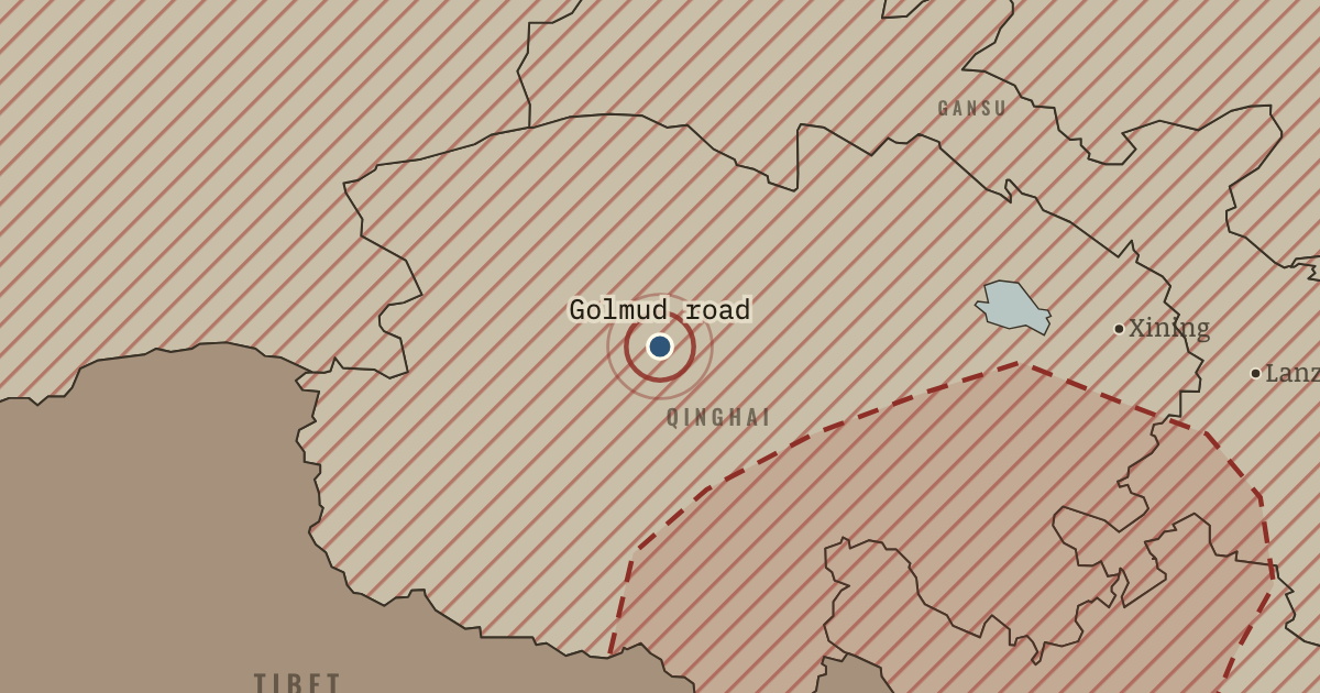
Qinghai–Tibet and Sichuan–Tibet highways
25 Dec 1954 — The Qinghai–Tibet and Sichuan–Tibet highways open to Lhasa, built largely by soldiers over passes above 4,000 metres; Golmud grew from the road-builders’ tent camp. For the first time a Chinese government could move an army and its supplies into Tibet by truck, which made the 1951 agreement enforceable on Beijing’s terms.
WW2 is free — every chapter. Try chapters 1–2 of any 2 other atlases (3 with a free account). Opening a new atlas uses one of them. Membership opens all 21 — Join.
The moment in context
The new state inherited a contradiction from the Qing, the Manchu empire that had ruled Mongols, Tibetans, Uyghurs and others beside the Han Chinese until 1912: it claimed an empire’s borders while calling itself the homeland of one nation. The Republic of China that replaced the Qing had lost control of Outer Mongolia, Tibet and much of Xinjiang, and the Communists meant to restore those borders. Xinjiang showed the easy way, because its Nationalist garrison, cut off after Chiang’s government fled, had nothing left to fight for and surrendered in September 1949. In 1954 demobilised soldiers became the Production and Construction Corps, a farming army that ran its own towns, much like the military settler colonies of earlier empires. It settled Han Chinese, over nine in ten of all Chinese, in a region where they had been about 6 percent of the people and where the Uyghurs, a Turkic-speaking Muslim people, were the largest group. The Xinjiang Uyghur Autonomous Region followed in 1955, and since each region’s Communist Party secretary outranked its government, much as a company’s owner outranks its local managers, autonomy put Uyghur faces in office and left power in Han hands.
From Tibet and Xinjiang under Mao, chapter 3 of The People’s Republic under Mao, 1949–1976 (1956).
The place: Qinghai–Tibet and Sichuan–Tibet highways — map and full story →
Teach this in 5 minutes
- Why it happened — The Qing borders as a national claim. Both the Nationalists and the Communists treated the borders of the Qing empire at its height as the rightful borders of China, so Tibet’s…
- The turn — Lithang, February–March 1956. The siege and bombing of Lithang’s monastery marks the hinge because it showed that the 1951 bargain could not survive the Party’s campaigns next…
- What it changed — Tibet transformed after 1959. The rising gave Beijing the reason to end the bargain of 1951. With the old government dissolved, it carried out land reform in Tibet in 1959–61,…
Then ask the room: Was the People’s Republic of the 1950s a nation-state or an empire on its frontiers? The argued answer is on the chapter page →
The atlas that shows it
THE FREE PRINTABLE STUDY GUIDE
Join the Dispatch — a short welcome series, then a letter when a new atlas opens — and the printable study guide for The People’s Republic under Mao is yours now, free.
NO TRACKING · YOUR ADDRESS IS USED FOR THE DISPATCH AND NOTHING ELSE · UNSUBSCRIBE ANYTIME