Norse and Aztecs · TURNING POINT ·
Nezahualcoyotl’s dike (c. 1449)
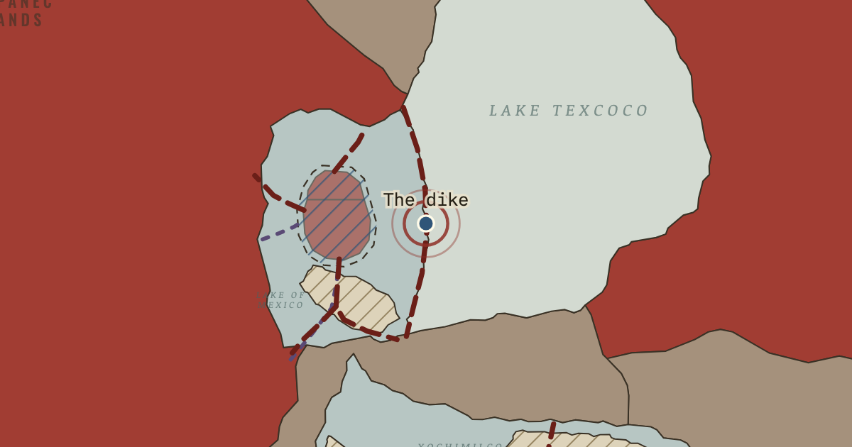
c. 1449 — Directed by Nezahualcoyotl at the request of Moctezuma I, a wall of stone and clay held between rows of stakes ran about 16 kilometres from Atzacoalco to Iztapalapa. It kept floods and the salty eastern lake away from Tenochtitlan, turning the western lagoon fresher.
- When
- Type
- Turning point
- Chapter
- Aztec dikes, aqueducts and floods (chapter 8 of Norse and Aztecs)
- Atlas
- Climate and Innovation: The Norse and the Aztecs, c. 790–1521
Chapter 8 is part of membership. WW2 is free — every chapter. Try chapters 1–2 of any 2 other atlases (3 with a free account). Opening a new atlas uses one of them. Membership opens all 21 — Join.
Free printable Norse and Aztecs study guide, sent by email ↓
In the same chapter
Related
THE FREE PRINTABLE STUDY GUIDE
Join the Dispatch — a short welcome series, then a letter when a new atlas opens — and the printable study guide for Climate and Innovation is yours now, free.
NO TRACKING · YOUR ADDRESS IS USED FOR THE DISPATCH AND NOTHING ELSE · UNSUBSCRIBE ANYTIME