The Great War, 1871–1923 · THE MAP IN
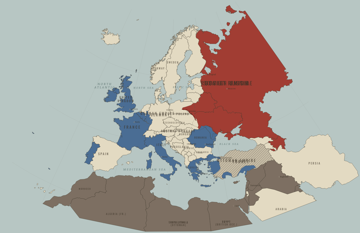
Map of Europe in August 1920
Warsaw and Sèvres · after WWI
Europe in August 1920: Warsaw and Sèvres. Since June 1919, 5 territories changed status on this map: including German Empire, East Prussia (German Empire), Austria-Hungary and 2 more.
Open this map in the interactive atlas →
WW2 is free — every chapter. Try chapters 1–2 of any 2 other atlases (3 with a free account). Opening a new atlas uses one of them. Membership opens all 21 — Join.
What changes on the map
| German Empire | Empires in collapse (1918–22) → Neutral or unaligned |
| East Prussia (German Empire) | Empires in collapse (1918–22) → Neutral or unaligned |
| Austria-Hungary | Empires in collapse (1918–22) → Neutral or unaligned |
| Hungary (Austria-Hungary) | Empires in collapse (1918–22) → Neutral or unaligned |
| Azerbaijan (Russian Empire) | Neutral or unaligned → Russia in revolution |
On the ground
- held by the Red Army at its furthest advance, mid-August 1920
- east of the Dniester: Soviet territory between the wars
- partitioned by the Treaty of Sèvres (1920): Greek, Allied, Italian and French zones of occupation (blue) around the Ankara nationalists’ Anatolia
- Eastern Thrace, assigned to Greece at Sèvres (1920) and returned to Turkey in 1922–23
- Constantinople and the Bosphorus under Allied occupation, 1918–23
- the Dardanelles shores, an Allied-controlled zone of the Straits
- the Antalya region under Italian occupation, 1919–21
- Cilicia under French occupation, 1919–21
Related maps
THE FREE PRINTABLE STUDY GUIDE
Join the Dispatch — a short welcome series, then a letter when a new atlas opens — and the printable study guide for WWI is yours now, free.
NO TRACKING · YOUR ADDRESS IS USED FOR THE DISPATCH AND NOTHING ELSE · UNSUBSCRIBE ANYTIME