The Industrial Revolution, 1750–1914 · THE MAP AROUND
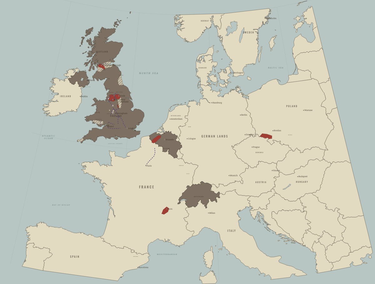
Map of the Industrial Revolution in Europe around 1820
Coal, iron and the canal network
The Industrial Revolution in Europe around 1820: Coal, iron and the canal network. Since 1800, 2 territories changed status on this map: Belgium (Austrian Netherlands to 1795; independent 1830) and Switzerland.
WW2 is free — every chapter. Try chapters 1–2 of any 2 other atlases (3 with a free account). Opening a new atlas uses one of them. Membership opens all 21 — Join.
Free printable Industrial Revolution study guide, sent by email ↓
What changes on the map
| Belgium (Austrian Netherlands to 1795; independent 1830) | — → Industrialising |
| Switzerland | — → Industrialising |
On the ground
- the Great Northern Coalfield of Northumberland and Durham, the oldest large coal trade in the world
- the Lancashire coalfield, which fuelled the cotton towns built on top of it
- the Yorkshire, Derbyshire and Nottinghamshire coalfield, from Leeds to Nottingham
- the North Staffordshire coalfield beneath the Potteries
- the South Staffordshire coalfield — the Black Country of iron, nails and chains
- the small Shropshire coalfield around Coalbrookdale, cradle of coke iron
- the South Wales coalfield, home of Merthyr’s ironworks and later of steam coal for the world’s navies
- the coalfields of Scotland’s central belt, from Ayrshire to Fife
- the copper and tin mines of Cornwall, pumped dry by Watt’s engines
The chapters of this moment
Related maps
THE FREE PRINTABLE STUDY GUIDE
Join the Dispatch — a short welcome series, then a letter when a new atlas opens — and the printable study guide for The Industrial Revolution is yours now, free.
NO TRACKING · YOUR ADDRESS IS USED FOR THE DISPATCH AND NOTHING ELSE · UNSUBSCRIBE ANYTIME