ONE LAND · 7 ATLASES
History of the Democratic Republic of the Congo in maps
The Democratic Republic of the Congo as it appears in 7 interactive history atlases, from 1890 to 2015: Congo, Belgian Congo, Democratic Republic of the Congo, Congo / Zaïre. Each era below lists who ruled the land and when control changed, linked to the dated map that shows it.
WW2 is free — every chapter. Try chapters 1–2 of any 2 other atlases (3 with a free account). Opening a new atlas uses one of them. Membership opens all 21 — Join.
Free printable Feminism and the Tunisian Revolution study guide, sent by email ↓
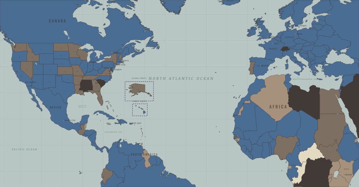
What was the Democratic Republic of the Congo before it was Democratic Republic of the Congo? Below, every era of this land in the Maps of History atlases — who ruled it, what it was called, and when control changed — each line linked to the dated map that shows it. Modern borders stand in as an honest approximation; every atlas says so on the map itself.
Congo (Congo Free State 1885–1908, then Belgian) · Industrial Revolution
The Congo basin was claimed in 1885 by King Leopold II of the Belgians as his personal Congo Free State. To meet industrial Europe’s demand for rubber, his agents forced villagers to collect it under threat of hostage-taking, mutilation and death; the population losses are disputed, from about one million to perhaps ten million people. International protest led Belgium to take over the colony in 1908.
| Colony or dependency — the opening position | |
| Colony or dependency |
INDUSTRIAL REVOLUTION: EVERY CHAPTER AND MAP →
Congo · Haiti and Kenya independence
The Congo, King Leopold II’s private state from 1885 and a Belgian colony from 1908, became independent on 30 June 1960 and collapsed within weeks into mutiny, secession and Cold War intervention. Its crisis, watched from Nairobi and London, was a warning about what a hasty or mismanaged handover could bring.
| Under colonial rule — the opening position | |
| Other states and societies |
HAITI AND KENYA INDEPENDENCE: EVERY CHAPTER AND MAP →
Belgian Congo · WWI
| Entente-aligned & imperial territories — the opening position | |
| Entente-aligned & imperial territories |
Democratic Republic of the Congo · Road to WW2
| Colonial empires & possessions — the opening position |
ROAD TO WW2: EVERY CHAPTER AND MAP →
Congo (Zaïre) · Cold War
The Congo: decolonization’s cautionary tale. Independence in 1960 collapsed into secession and superpower bidding within weeks; Lumumba, its elected premier, was murdered with CIA and Belgian complicity (Ch. 8); Mobutu’s Western-backed kleptocracy ruled — and hollowed — the country for thirty-two years. The bill came due in the wars of the 1990s.
| Non-aligned & neutral — the opening position | |
| Non-aligned & neutral |
COLD WAR: EVERY CHAPTER AND MAP →
Congo / Zaïre · Decolonization of Africa
The Belgian Congo — enormous, mineral-rich, and deliberately left without trained administrators or officers — collapsed within days of independence on 30 June 1960. Lumumba’s murder, Katanga’s copper secession, the UN’s first war, and finally Mobutu’s thirty-two-year kleptocracy made the Congo the era’s great cautionary tale of how colonial misrule and Cold War intervention could strangle a new nation at birth. Renamed Zaïre, then Congo again.
| Portuguese, Belgian, Spanish & Italian-ruled — the opening position | |
| Independent Africa |
DECOLONIZATION OF AFRICA: EVERY CHAPTER AND MAP →
Democratic Republic of the Congo · Feminism and the Tunisian Revolution
FEMINISM AND THE TUNISIAN REVOLUTION: EVERY CHAPTER AND MAP →
Related
THE FREE PRINTABLE STUDY GUIDE
Join the Dispatch — a short welcome series, then a letter when a new atlas opens — and a printable atlas study guide of your choice is yours now, free.
NO TRACKING · YOUR ADDRESS IS USED FOR THE DISPATCH AND NOTHING ELSE · UNSUBSCRIBE ANYTIME