The Decolonization of Africa, 1945–1994 · THE MAP IN
Map of Africa in 1960
The Year of Africa · decolonization
Africa in 1960: The Year of Africa. Since October 1958, 18 territories changed status on this map: including Cameroon, Togo, Madagascar and 15 more.
Open this map in the interactive atlas →
WW2 is free — every chapter. Try chapters 1–2 of any 2 other atlases (3 with a free account). Opening a new atlas uses one of them. Membership opens all 21 — Join.
Free printable Decolonization of Africa study guide, sent by email ↓
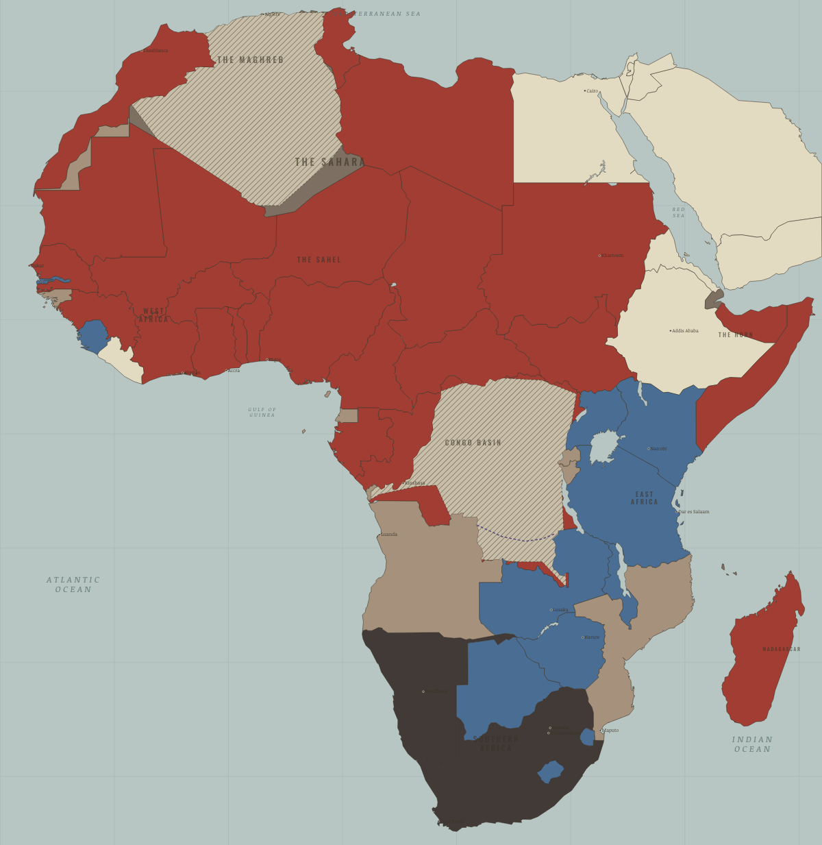
What changes on the map
| Cameroon | French-ruled → Independent Africa |
| Togo | French-ruled → Independent Africa |
| Madagascar | French-ruled → Independent Africa |
| Congo / Zaïre | Portuguese, Belgian, Spanish & Italian-ruled → Independent Africa |
| Somalia | Portuguese, Belgian, Spanish & Italian-ruled → Independent Africa |
| British Somaliland | British-ruled → Independent Africa |
| Benin (Dahomey) | French-ruled → Independent Africa |
| Niger | French-ruled → Independent Africa |
| Burkina Faso (Upper Volta) | French-ruled → Independent Africa |
| Côte d’Ivoire | French-ruled → Independent Africa |
| Chad | French-ruled → Independent Africa |
| Central African Republic | French-ruled → Independent Africa |
| Congo-Brazzaville | French-ruled → Independent Africa |
| Gabon | French-ruled → Independent Africa |
| Senegal | French-ruled → Independent Africa |
| Mali (French Sudan) | French-ruled → Independent Africa |
| Nigeria | British-ruled → Independent Africa |
| Mauritania | French-ruled → Independent Africa |
On the ground
- the Congo Crisis: secession, mutiny and the UN’s first war, 1960–65
The chapters of this moment
Related maps
THE FREE PRINTABLE STUDY GUIDE
Join the Dispatch — a short welcome series, then a letter when a new atlas opens — and the printable study guide for The Decolonization of Africa is yours now, free.
NO TRACKING · YOUR ADDRESS IS USED FOR THE DISPATCH AND NOTHING ELSE · UNSUBSCRIBE ANYTIME