ONE LAND · 9 ATLASES
History of Turkmenistan in maps
Turkmenistan as it appears in 9 interactive history atlases, from 1206 to 2000: Khwarazm & Khorasan, Turkmenistan, Transcaspia, the Turkmen SSR, Soviet Turkmenistan. Each era below lists who ruled the land and when control changed, linked to the dated map that shows it.
WW2 is free — every chapter. Try chapters 1–2 of any 2 other atlases (3 with a free account). Opening a new atlas uses one of them. Membership opens all 21 — Join.
Free printable Russian Revolution study guide, sent by email ↓
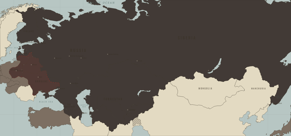
What was Turkmenistan before it was Turkmenistan? Below, every era of this land in the Maps of History atlases — who ruled it, what it was called, and when control changed — each line linked to the dated map that shows it. Modern borders stand in as an honest approximation; every atlas says so on the map itself.
Khwarazm & Khorasan (mod. Turkmenistan) · Mongol Empire
| The Islamic powers — the opening position | |
| The Mongol Empire |
MONGOL EMPIRE: EVERY CHAPTER AND MAP →
Turkmenistan · Industrial Revolution
| Colony or dependency — the opening position | |
| Colony or dependency |
INDUSTRIAL REVOLUTION: EVERY CHAPTER AND MAP →
Turkmenistan · Meiji Japan and post-Soviet Russia
Turkmenistan, a desert republic with vast natural gas reserves, voted overwhelmingly to keep the Union in March 1991 and became independent only when it dissolved. Its party chief Saparmurat Niyazov made himself president for life and built a personality cult, renaming months of the year after himself and his mother. It shows that the end of the Soviet state could leave Soviet-style rule in place.
| The USSR, then Russia — the opening position | |
| Independent neighbours |
MEIJI JAPAN AND POST-SOVIET RUSSIA: EVERY CHAPTER AND MAP →
Transcaspia (mod. Turkmenistan) · Russian Revolution
The Turkmen were the last people of Central Asia to be conquered, after the storming of Geok Tepe in 1881 and the submission of Merv in 1884. Transcaspia saw one of the intervention’s stranger episodes — a local anti-Bolshevik government backed briefly by British troops from Persia. Reconquered into Soviet Turkestan by 1920; the Turkmen would resist collectivization into the 1930s.
| Neutral or independent — the opening position | |
| The Tsarist empire | |
| Provisional Government, then the Whites | |
| Contested / peasant war | |
| Soviet power |
RUSSIAN REVOLUTION: EVERY CHAPTER AND MAP →
Russian Turkestan (mod. Turkmenistan) · Indian independence
The Transcaspian edge of Russian Turkestan: conquered in the 1880s (the massacre at Gök Tepe broke Turkmen resistance), crossed by the tsars’ strategic railway that made British India’s planners lose sleep for a generation. The Great Game’s whole logic — Afghanistan as buffer, Persia as sphere — was drawn against this coast. By this map’s era the frontier had gone quiet; the anxiety it bred had already shaped the Raj’s northwest forever.
| Beyond the Raj · Portuguese & French India — the opening position |
INDIAN INDEPENDENCE: EVERY CHAPTER AND MAP →
Turkmenistan · WWI
| The Entente & Allies — the opening position | |
| Russia in revolution |
The Turkmen SSR · Stalin’s Soviet Union
The Turkmen republic, created in 1924 from parts of Turkestan, Bukhara and Khorezm, covered the Karakum desert and the oases along the Iranian border. Collectivisation and the forced settlement of nomadic Turkmen tribes provoked armed revolts in the early 1930s, and many families fled to Iran and Afghanistan. Its capital, Ashkhabad, was destroyed by an earthquake in October 1948 that killed tens of thousands, a disaster the Soviet press barely reported.
| The Soviet Union — the opening position |
STALIN’S SOVIET UNION: EVERY CHAPTER AND MAP →
Soviet Turkmenistan · Road to WW2
| Neutral & unaligned — the opening position | |
| Aggressor clients & partners | |
| Democracies & powers fighting them |
ROAD TO WW2: EVERY CHAPTER AND MAP →
Turkmenistan · Cold War
| USSR & Warsaw Pact — the opening position | |
| Non-aligned & neutral |
COLD WAR: EVERY CHAPTER AND MAP →
Related
THE FREE PRINTABLE STUDY GUIDE
Join the Dispatch — a short welcome series, then a letter when a new atlas opens — and a printable atlas study guide of your choice is yours now, free.
NO TRACKING · YOUR ADDRESS IS USED FOR THE DISPATCH AND NOTHING ELSE · UNSUBSCRIBE ANYTIME