ONE LAND · 13 ATLASES
History of Lebanon in maps
Lebanon as it appears in 13 interactive history atlases, from 264 BC to 2015: Phoenicia, the Lebanese coast — Tripoli & Tyre, the Levant coast, Lebanon. Each era below lists who ruled the land and when control changed, linked to the dated map that shows it.
WW2 is free — every chapter. No sign-up.
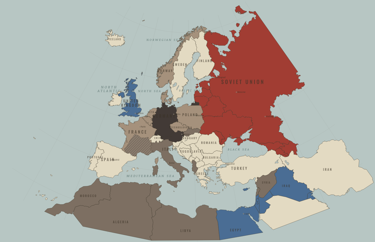
What was Lebanon before it was Lebanon? Below, every era of this land in the Maps of History atlases — who ruled it, what it was called, and when control changed — each line linked to the dated map that shows it. Modern borders stand in as an honest approximation; every atlas says so on the map itself.
Phoenicia (mod. Lebanon) · Ancient Rome
Phoenicia — the mother country of Carthage. Tyre and Sidon invented the alphabet Rome wrote with and the trade diaspora Rome fought in the west. Under the empire, a prosperous strip of ports and purple-dye works; Berytus (Beirut) housed the law schools where the classical jurists taught — one root of the Corpus Iuris that is Rome’s largest living legacy.
| 264 BC | Hellenistic kingdoms — the opening position |
| 62 BC | Roman territory |
| Breakaway Roman empires (260–274) | |
| Roman territory |
ANCIENT ROME: EVERY CHAPTER AND MAP →
The Lebanese coast — Tripoli & Tyre · Crusades
The Lebanese coast held two crusader capitals: the County of Tripoli, which lasted until Qalawun stormed and levelled it in 1289, and Tyre, the one great city that never fell to Saladin after Hattin and from which the kingdom was rebuilt. Its Maronite Christians often allied with the Franks, and its ports made Italian merchants rich.
| The Islamic powers — Seljuk, Zengid, Ayyubid, Mamluk — the opening position |
CRUSADES: EVERY CHAPTER AND MAP →
The Levant coast (mod. Lebanon) · Mongol Empire
| The Islamic powers — the opening position | |
| The Mongol Empire | |
| The Islamic powers |
MONGOL EMPIRE: EVERY CHAPTER AND MAP →
Lebanon · Industrial Revolution
| Opened by force or treaty — the opening position | |
| Opened by force or treaty |
INDUSTRIAL REVOLUTION: EVERY CHAPTER AND MAP →
Lebanon · Age of Revolutions
| Neutral / uncommitted — the opening position |
AGE OF REVOLUTIONS: EVERY CHAPTER AND MAP →
Lebanon · Meiji Japan and post-Soviet Russia
| Non-aligned or stateless — the opening position |
MEIJI JAPAN AND POST-SOVIET RUSSIA: EVERY CHAPTER AND MAP →
Lebanon (Ottoman Empire) · WWI
Lebanon · Stalin’s Soviet Union
STALIN’S SOVIET UNION: EVERY CHAPTER AND MAP →
Lebanon · Road to WW2
| Colonial empires & possessions — the opening position |
ROAD TO WW2: EVERY CHAPTER AND MAP →
Lebanon · WW2
| Western Allies — the opening position | |
| Axis allies & puppets | |
| Western Allies |
Lebanon · Cold War
| NATO & core Western allies — the opening position | |
| Non-aligned & neutral | |
| Non-aligned & neutral |
COLD WAR: EVERY CHAPTER AND MAP →
Lebanon · Feminism and the Tunisian Revolution
| Refused: women excluded; ERA never ratified — the opening position | |
| Right won in law | |
| No reform yet / outside this story |
FEMINISM AND THE TUNISIAN REVOLUTION: EVERY CHAPTER AND MAP →
Lebanon · Refugee crises
REFUGEE CRISES: EVERY CHAPTER AND MAP →
Related
THE FREE PRINTABLE STUDY GUIDE
Join the Dispatch — a short welcome series, then a letter when a new atlas opens — and a printable atlas study guide of your choice is yours now, free.
NO TRACKING · YOUR ADDRESS IS USED FOR THE DISPATCH AND NOTHING ELSE · UNSUBSCRIBE ANYTIME