ONE LAND · 11 ATLASES
History of Myanmar in maps
Myanmar as it appears in 11 interactive history atlases, from 1206 to 2000: Kingdom of Pagan, Burma, Myanmar. Each era below lists who ruled the land and when control changed, linked to the dated map that shows it.
WW2 is free — every chapter. No sign-up.
What was Myanmar before it was Myanmar? Below, every era of this land in the Maps of History atlases — who ruled it, what it was called, and when control changed — each line linked to the dated map that shows it. Modern borders stand in as an honest approximation; every atlas says so on the map itself.
Kingdom of Pagan (mod. Myanmar) · Mongol Empire
| Beyond the storm — the opening position | |
| Tributaries & vassals |
MONGOL EMPIRE: EVERY CHAPTER AND MAP →
Burma · Industrial Revolution
| Colony or dependency — the opening position | |
| Colony or dependency |
INDUSTRIAL REVOLUTION: EVERY CHAPTER AND MAP →
Burma (British from 1886) · Meiji Japan and post-Soviet Russia
| Independent neighbours — the opening position | |
| Western powers and allies |
MEIJI JAPAN AND POST-SOVIET RUSSIA: EVERY CHAPTER AND MAP →
Burma (annexed 1826–86; separated from India 1937) · Indian independence
A province of British India until 1937 — its coast taken in 1826 and 1852, its inland kingdom conquered from Mandalay in 1885, governed from Calcutta and Delhi, its rice feeding Bengal — then a separate colony, then the war’s most broken ground: occupied, fought over twice, its economy erased. Aung San’s Burma refused the Commonwealth outright and took independence on 4 January 1948, at an hour set by astrologers, its founder already six months assassinated. Separation in 1937 spared Burma partition’s knife and cost it India’s institutional ballast; its post-independence decades were the harder for both.
| Beyond the Raj · Portuguese & French India — the opening position | |
| British India — direct rule | |
| Crown colonies · Burma after 1937 | |
| Self-rule / independent |
INDIAN INDEPENDENCE: EVERY CHAPTER AND MAP →
Burma (British India) · WWI
| Entente-aligned & imperial territories — the opening position |
Burma (British to 1948) · Chinese Revolution
British Burma matters to this atlas for one road: the 1,100-kilometer mountain lifeline from Lashio to Kunming, dug largely by hand in 1937–38, over which besieged Free China breathed. Japan’s 1942 conquest cuts it and closes China’s last land door; the Ledo Road reopens it in 1945 through jungle at fantastic cost. Burma’s own nationalists — Aung San’s generation — ride the same war to independence in 1948: the British empire in Asia does not survive the decade this map ends in.
| Foreign empires — British, French, Russian, American — the opening position | |
| The Empire of Japan & its puppets | |
| Foreign empires — British, French, Russian, American |
CHINESE REVOLUTION: EVERY CHAPTER AND MAP →
Burma (British) · Road to WW2
| Colonial empires & possessions — the opening position |
ROAD TO WW2: EVERY CHAPTER AND MAP →
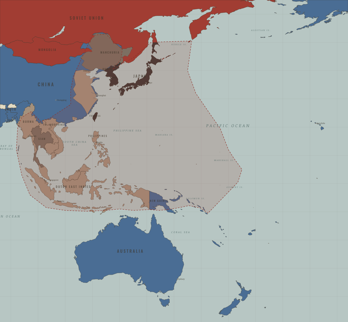
Myanmar · WW2
Burma saw the longest British campaign of the war: lost 1942, the Burma Road lifeline to China cut, retaken 1944–45 after Imphal/Kohima. Independence followed in 1948; the wartime mobilization of ethnic militias echoes in its conflicts today.
| Western Allies — the opening position | |
| Axis-occupied | |
| Western Allies |
Burma · Cold War
| NATO & core Western allies — the opening position | |
| Non-aligned & neutral |
COLD WAR: EVERY CHAPTER AND MAP →
Burma · Refugee crises
REFUGEE CRISES: EVERY CHAPTER AND MAP →
Burma · Mao’s China
| Neutral, non-aligned or colonial — the opening position |
MAO’S CHINA: EVERY CHAPTER AND MAP →
Related
THE FREE PRINTABLE STUDY GUIDE
Join the Dispatch — a short welcome series, then a letter when a new atlas opens — and a printable atlas study guide of your choice is yours now, free.
NO TRACKING · YOUR ADDRESS IS USED FOR THE DISPATCH AND NOTHING ELSE · UNSUBSCRIBE ANYTIME