The Industrial Revolution, 1750–1914 · THE MAP IN
Map of the industrial world in 1869
Suez and the golden spike
The industrial world in 1869: Suez and the golden spike. Since 1861, 7 territories changed status on this map: including Japan, Siam (mod. Thailand), Burma and 4 more.
Open this map in the interactive atlas →
WW2 is free — every chapter. Try chapters 1–2 of any 2 other atlases (3 with a free account). Opening a new atlas uses one of them. Membership opens all 21 — Join.
Free printable Industrial Revolution study guide, sent by email ↓
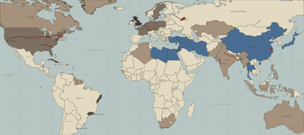
What changes on the map
| Japan | — → Opened by force or treaty |
| Siam (mod. Thailand) | — → Opened by force or treaty |
| Burma | — → Colony or dependency |
| Netherlands | — → Industrialising |
| Luxembourg | — → Industrialising |
| The Polish lands (Prussian, Russian and Austrian) | — → Industrialising |
| Sweden | — → Industrialising |
On the ground
- the jute mills along the Hooghly around Calcutta
- the cotton mill belt of Bombay and Ahmedabad, built by Indian merchants from 1854
- the Lake Superior iron ranges, from Marquette to the Mesabi
Related maps
THE FREE PRINTABLE STUDY GUIDE
Join the Dispatch — a short welcome series, then a letter when a new atlas opens — and the printable study guide for The Industrial Revolution is yours now, free.
NO TRACKING · YOUR ADDRESS IS USED FOR THE DISPATCH AND NOTHING ELSE · UNSUBSCRIBE ANYTIME