Norse and Aztecs · TURNING POINT ·
Norðrseta walrus hunting grounds (1000–1350)
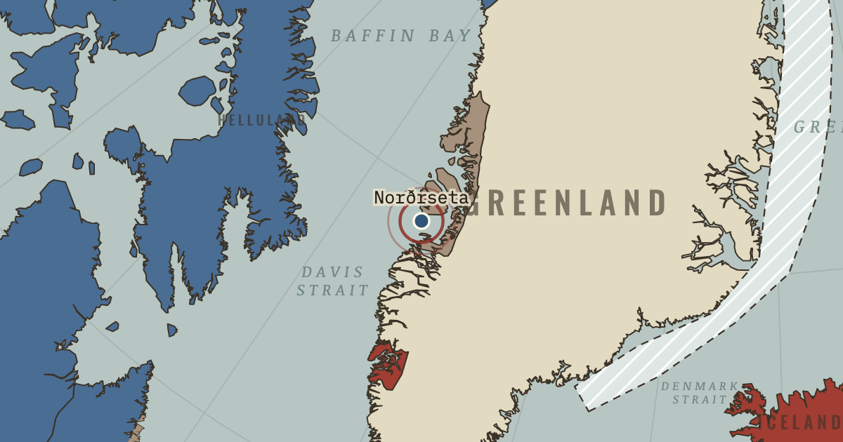
On the Norse and Aztecs map as “Norðrseta — the walrus grounds”
c. 1000–1350 — The northern hunting grounds around Disko Bay, some 800 kilometres north of the Eastern Settlement, where Norse men rowed each summer to hunt walrus for their tusks and hides. By the twelfth century almost all walrus ivory reaching Europe came from Greenland.
- When
- Type
- Turning point
- Chapter
- Vikings in Greenland and Vinland (chapter 4 of Norse and Aztecs)
- Atlas
- Climate and Innovation: The Norse and the Aztecs, c. 790–1521
Chapter 4 is part of membership. WW2 is free — every chapter. Try chapters 1–2 of any 2 other atlases (3 with a free account). Opening a new atlas uses one of them. Membership opens all 21 — Join.
Free printable Norse and Aztecs study guide, sent by email ↓
In the same chapter
Related
THE FREE PRINTABLE STUDY GUIDE
Join the Dispatch — a short welcome series, then a letter when a new atlas opens — and the printable study guide for Climate and Innovation is yours now, free.
NO TRACKING · YOUR ADDRESS IS USED FOR THE DISPATCH AND NOTHING ELSE · UNSUBSCRIBE ANYTIME