ONE LAND · 10 ATLASES
History of South Korea in maps
South Korea as it appears in 10 interactive history atlases, from 1206 to 2000: Goryeo, Korea, South Korea, Chōsen — Japanese Korea, Chosen — Japanese Korea. Each era below lists who ruled the land and when control changed, linked to the dated map that shows it.
WW2 is free — every chapter. No sign-up.
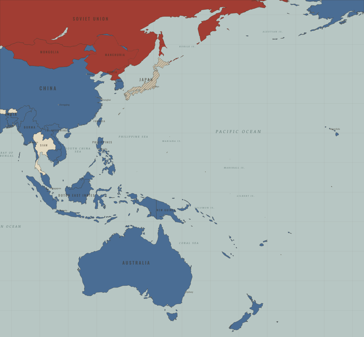
What was South Korea before it was South Korea? Below, every era of this land in the Maps of History atlases — who ruled it, what it was called, and when control changed — each line linked to the dated map that shows it. Modern borders stand in as an honest approximation; every atlas says so on the map itself.
Goryeo (mod. South Korea) · Mongol Empire
The southern half of vassal Goryeo — same kingdom, same terms: royal house preserved by marriage into the khan’s family, autonomy in exchange for tribute, troops and ships. Goryeo’s survival-by-diplomacy is the era’s case study in small-state statecraft between empires.
| Other settled powers (Jin China, Christendom, Delhi) — the opening position | |
| Tributaries & vassals |
MONGOL EMPIRE: EVERY CHAPTER AND MAP →
Korea (Japanese from 1910) · Industrial Revolution
Opened by Japanese gunboats in 1876 through a treaty modelled on those the West had forced on Japan, Korea became a Japanese protectorate in 1905 and was annexed in 1910. Japanese railways and a colonial land survey turned its farms toward feeding Japan, and many Koreans lost their land. Korean resistance continued throughout the colonial period.
| Opened by force or treaty — the opening position | |
| Opened by force or treaty | |
| Colony or dependency |
INDUSTRIAL REVOLUTION: EVERY CHAPTER AND MAP →
Korea (Joseon, then Japanese Chōsen; mod. South Korea) · Meiji Japan and post-Soviet Russia
Joseon Korea, ruled by one dynasty since 1392, was opened by Japanese gunboats in 1876, fought over by China and Japan in 1894 and by Russia and Japan in 1904, made a protectorate in 1905 and annexed in 1910. Its righteous armies fought on for years, and the memory of colonisation still shapes its relations with Japan. On the Eurasia map South Korea stands as an American ally, divided from the North since 1945.
| Independent neighbours — the opening position | |
| Domains, vassals, protectorates | |
| Meiji Japan and its empire |
MEIJI JAPAN AND POST-SOVIET RUSSIA: EVERY CHAPTER AND MAP →
South Korea · WWI
| Entente-aligned & imperial territories — the opening position | |
| Entente-aligned & imperial territories |
Chōsen — Japanese Korea (mod. South Korea) · Chinese Revolution
Chōsen under Japanese rule: the colony that shows China its possible future. The March First movement of 1919 — two months before May Fourth, and an inspiration to it — is suppressed with hundreds of deaths; Korean guerrillas fight Japan in Manchuria alongside Chinese Communists (Kim Il-sung among them); Korean conscripts and laborers are spread across the empire’s wars. Liberation in 1945 arrives as division at the 38th parallel — and within a year of this atlas’s last frame, the new Chinese state is at war on this peninsula.
| The Empire of Japan & its puppets — the opening position | |
| Foreign empires — British, French, Russian, American |
CHINESE REVOLUTION: EVERY CHAPTER AND MAP →
Korea (south) · Stalin’s Soviet Union
| Rivals & the Western bloc — the opening position |
STALIN’S SOVIET UNION: EVERY CHAPTER AND MAP →
Chosen — Japanese Korea · Road to WW2
| The aggressors (Japan, Germany, Italy) — the opening position |
ROAD TO WW2: EVERY CHAPTER AND MAP →
South Korea · WW2
A Japanese colony since 1910 — its people conscripted as laborers and soldiers, its women forced into military brothels. Liberated in 1945 only to be split at the 38th parallel between Soviet and American zones (Ch. 14): the war’s most durable unhealed wound.
| Axis powers — the opening position | |
| Western Allies |
South Korea · Cold War
Liberated in 1945 into a partition nobody planned to keep, invaded in 1950, saved at Pusan and Inchon, and frozen since 1953 behind the DMZ (Ch. 4). Postwar South Korea was poor, authoritarian and US-garrisoned; it built an industrial democracy anyway — the Western column’s strongest late argument.
| NATO & core Western allies — the opening position | |
| US-aligned states |
COLD WAR: EVERY CHAPTER AND MAP →
South Korea (the Republic of Korea) · Mao’s China
South Korea, the Republic of Korea, survived the war of 1950–53 under American protection, with an American army stationed on its soil. Beijing regarded it as a client of the United States and had no relations with it throughout the Mao years. Its rapid industrial growth from the 1960s, under the military ruler Park Chung-hee, offered a contrasting model of authoritarian development on China’s doorstep.
| Beijing’s adversaries — the opening position |
MAO’S CHINA: EVERY CHAPTER AND MAP →
Related
THE FREE PRINTABLE STUDY GUIDE
Join the Dispatch — a short welcome series, then a letter when a new atlas opens — and a printable atlas study guide of your choice is yours now, free.
NO TRACKING · YOUR ADDRESS IS USED FOR THE DISPATCH AND NOTHING ELSE · UNSUBSCRIBE ANYTIME