ONE LAND · 11 ATLASES
History of Thailand in maps
Thailand as it appears in 11 interactive history atlases, from 1840 to 2000: Siam, Thailand. Each era below lists who ruled the land and when control changed, linked to the dated map that shows it.
WW2 is free — every chapter. No sign-up.
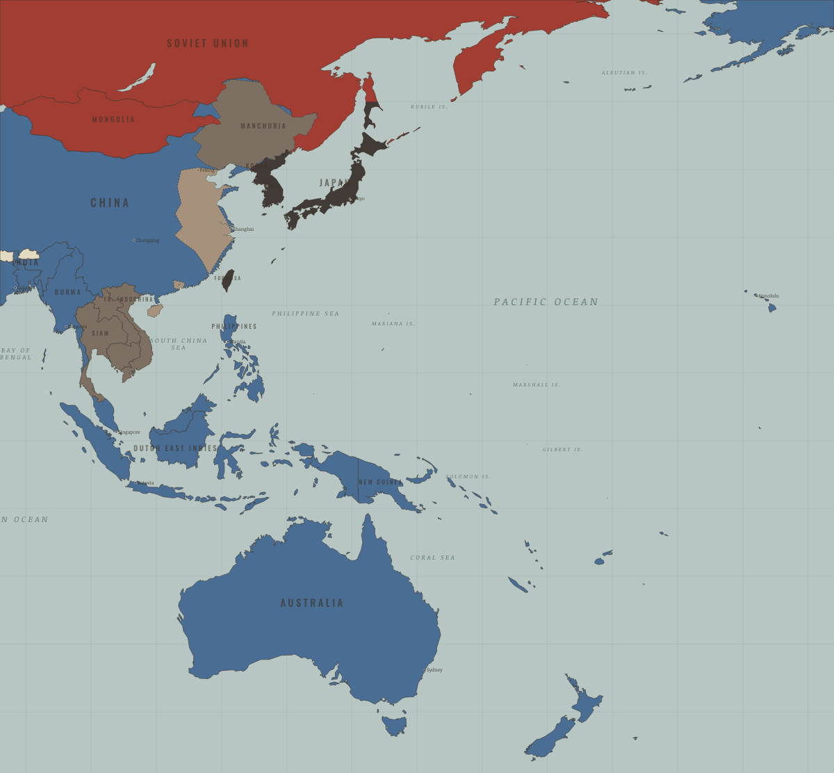
What was Thailand before it was Thailand? Below, every era of this land in the Maps of History atlases — who ruled it, what it was called, and when control changed — each line linked to the dated map that shows it. Modern borders stand in as an honest approximation; every atlas says so on the map itself.
Sukhothai & Lan Na (mod. Thailand) · Mongol Empire
| Beyond the storm — the opening position |
MONGOL EMPIRE: EVERY CHAPTER AND MAP →
Siam (mod. Thailand) · Industrial Revolution
| Opened by force or treaty — the opening position | |
| Opened by force or treaty |
INDUSTRIAL REVOLUTION: EVERY CHAPTER AND MAP →
Siam (mod. Thailand) · Meiji Japan and post-Soviet Russia
| Independent neighbours — the opening position |
MEIJI JAPAN AND POST-SOVIET RUSSIA: EVERY CHAPTER AND MAP →
Siam (mod. Thailand) · Indian independence
Siam alone in southern Asia kept its sovereignty throughout — squeezed between British Burma and French Indochina and playing each against the other with treaty concessions and railway diplomacy. Renamed Thailand in 1939, it bent with the Japanese storm in 1941 (declaring war on Britain; the ambassador in Washington famously declined to deliver the declaration) and bent back after. The subcontinent’s struggle barely touched it; its example — modernize the court, concede the edges, keep the center — was the road the princely states never found.
| Beyond the Raj · Portuguese & French India — the opening position |
INDIAN INDEPENDENCE: EVERY CHAPTER AND MAP →
Siam · WWI
| The Entente & Allies — the opening position | |
| The Entente & Allies |
Siam (Thailand from 1939) · Chinese Revolution
Siam — the region’s only uncolonized state, renamed Thailand in 1939 by a nationalist government that had learned the era’s lessons: modernize the army, court the strong. Phibun’s regime aligns with Japan in December 1941 (after a few hours’ resistance) and declares war on Britain and the United States; Washington, deftly, never accepts the declaration, and Bangkok ends the war on the winners’ side of the ledger — the era’s smoothest exercise in small-state survival between empires.
| Neutral / de-facto independent — the opening position | |
| The Empire of Japan & its puppets | |
| Neutral / de-facto independent |
CHINESE REVOLUTION: EVERY CHAPTER AND MAP →
Siam (mod. Thailand) · Road to WW2
Siam: the region’s only uncolonized state, renamed Thailand in 1939, it navigated by leaning — a border war with Vichy Indochina in 1940–41 (arbitrated, pointedly, by Japan), then a few hours of resistance on 8 December 1941 before allowing Japanese passage and, within weeks, alliance. Small-state survival on the aggressor’s doorstep: bend, and keep the state.
| Neutral & unaligned — the opening position | |
| Aggressor clients & partners |
ROAD TO WW2: EVERY CHAPTER AND MAP →
Thailand · WW2
Siam bent rather than broke: allowed Japanese passage, declared war on the Allies (its ambassador in Washington refused to deliver the declaration — diplomacy’s finest technicality), and emerged treated as a victim rather than an ally of Japan.
| Neutral — the opening position | |
| Axis allies & puppets | |
| Neutral |
Thailand · Cold War
| US-aligned states — the opening position | |
| US-aligned states |
COLD WAR: EVERY CHAPTER AND MAP →
Thailand · Refugee crises
Thailand was the region’s great receiving state and its least predictable one. It took Lao, Hmong and Cambodians from 1975, forced more than 42,000 Cambodians back at Preah Vihear in June 1979, opened its border that October, adopted “humane deterrence” in 1981 and sheltered the Cambodian border camps for a decade. It never signed the Refugee Convention, so every policy was a political choice.
| Western bloc or democracy — the opening position | |
| First asylum open | |
| First asylum restricted | |
| First asylum open | |
| First asylum restricted | |
| First asylum open |
REFUGEE CRISES: EVERY CHAPTER AND MAP →
Thailand · Mao’s China
| Beijing’s adversaries — the opening position | |
| Neutral, non-aligned or colonial |
MAO’S CHINA: EVERY CHAPTER AND MAP →
Related
THE FREE PRINTABLE STUDY GUIDE
Join the Dispatch — a short welcome series, then a letter when a new atlas opens — and a printable atlas study guide of your choice is yours now, free.
NO TRACKING · YOUR ADDRESS IS USED FOR THE DISPATCH AND NOTHING ELSE · UNSUBSCRIBE ANYTIME