The Industrial Revolution, 1750–1914 · THE MAP AROUND
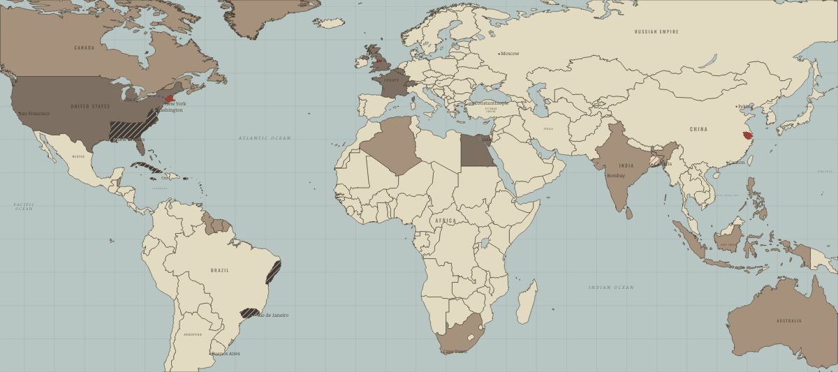
Map of the industrial world around 1830
The Cotton Kingdom and an independent Latin America
The industrial world around 1830: The Cotton Kingdom and an independent Latin America. Since 1806, 25 territories changed status on this map: including Mexico (New Spain to 1821), Guatemala, Honduras and 22 more.
WW2 is free — every chapter. Try chapters 1–2 of any 2 other atlases (3 with a free account). Opening a new atlas uses one of them. Membership opens all 21 — Join.
Free printable Industrial Revolution study guide, sent by email ↓
What changes on the map
| Mexico (New Spain to 1821) | Colony or dependency → Agrarian economy |
| Guatemala | Colony or dependency → Agrarian economy |
| Honduras | Colony or dependency → Agrarian economy |
| El Salvador | Colony or dependency → Agrarian economy |
| Nicaragua | Colony or dependency → Agrarian economy |
| Costa Rica | Colony or dependency → Agrarian economy |
| Panama | Colony or dependency → Agrarian economy |
| Colombia | Colony or dependency → Agrarian economy |
| Venezuela | Colony or dependency → Agrarian economy |
| Ecuador | Colony or dependency → Agrarian economy |
| Peru | Colony or dependency → Agrarian economy |
| Bolivia | Colony or dependency → Agrarian economy |
| Chile | Colony or dependency → Agrarian economy |
| Argentina | Colony or dependency → Agrarian economy |
| Uruguay | Colony or dependency → Agrarian economy |
| Paraguay | Colony or dependency → Agrarian economy |
| Brazil (Portuguese to 1822) | Colony or dependency → Agrarian economy |
| Dominican Republic | Colony or dependency → Agrarian economy |
| The United States (British colonies to 1776) | Agrarian economy → Industrialising |
| Belgium (Austrian Netherlands to 1795; independent 1830) | — → Industrialising |
| Switzerland | — → Industrialising |
| France | — → Industrialising |
| India | — → Colony or dependency |
| Algeria | — → Colony or dependency |
On the ground
- the Cotton Kingdom of c. 1830, spreading west on enslaved labour
- the coffee plantations of the Paraíba valley and São Paulo, worked by enslaved people until 1888
- the Bengal weaving district in decline after its export markets were lost to machine-made cloth
- the New England textile district of Lowell, Fall River and Providence
Related maps
THE FREE PRINTABLE STUDY GUIDE
Join the Dispatch — a short welcome series, then a letter when a new atlas opens — and the printable study guide for The Industrial Revolution is yours now, free.
NO TRACKING · YOUR ADDRESS IS USED FOR THE DISPATCH AND NOTHING ELSE · UNSUBSCRIBE ANYTIME