Historical map · 900
Map of the World in 900
In 900, the historical border data behind our interactive map draws 115 states, empires and other polities in the world. By the land they held , the largest were the Alliance between Samanid Empire and Ziyadid dynasty, the Tang Dynasty and the Allegiance of Ziyadid dynasty to Abbasid Caliphate.
See this map live. The interactive map opens on the World in 900. Zoom in, move the year slider to watch the borders change, or ask the history guide a question and it draws the answer on the map.
OPEN 900 ON THE MAP →Ask the history guide about 900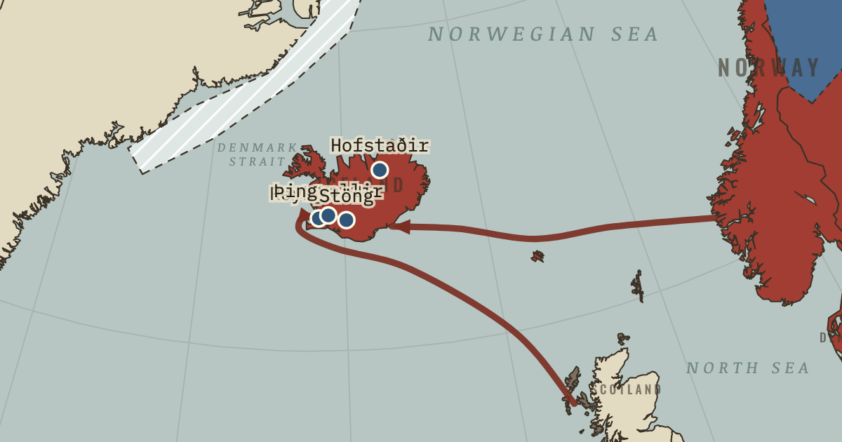
States and empires in the World in 900
| State | Territory | In the data |
|---|---|---|
| Alliance between Samanid Empire and Ziyadid dynasty Wikipedia | 5.1 million km² | 886–999 |
| Tang Dynasty Wikipedia | 3.1 million km² | 623–910 |
| Allegiance of Ziyadid dynasty to Abbasid Caliphate Wikipedia | 2.9 million km² | 866–1138 |
| Abbasid Caliphate Wikipedia | 2.4 million km² | 750–1259 |
| Tibetans Wikipedia | 1.9 million km² | 850–1259 |
| Allegiance of East Franks to Carolingian Empire Wikipedia | 1.7 million km² | 850–910 |
| Kimek-Kipchak confederation Wikipedia | 1.4 million km² | 750–1235 |
| Carolingian Empire Wikipedia | 1.2 million km² | 462–989 |
| Kievan Rus' Wikipedia | 986,000 km² | 880–1240 |
| Tulunids Wikipedia | 974,000 km² | 875–910 |
| Rashtrakuta Dynasty Wikipedia | 788,000 km² | 755–989 |
| Khazaria Wikipedia | 748,000 km² | 630–979 |
| Qocho Kingdom Wikipedia | 652,000 km² | 860–1138 |
| Gurjara-Pratihara Dynasty Wikipedia | 645,000 km² | 732–1039 |
| Byzantine Empire Wikipedia | 634,000 km² | 633–1474 |
| Srivijaya Wikipedia | 540,000 km² | 674–1293 |
| Balhae Wikipedia | 482,000 km² | 705–925 |
| Rustamid dynasty Wikipedia | 470,000 km² | 778–910 |
| Oghuz Turks Wikipedia | 449,000 km² | 666–1055 |
| Yenisei Kyrgyz Wikipedia | 422,000 km² | 555–1219 |
| Kara-Khanids Wikipedia | 408,000 km² | 850–1138 |
| Emirate of Córdoba Wikipedia | 406,000 km² | 757–935 |
| Khmer Empire Wikipedia | 399,000 km² | 800–1539 |
| West Franks Wikipedia | 375,000 km² | 850–989 |
| Pala Empire Wikipedia | 329,000 km² | 750–1168 |
| Nanzhao Wikipedia | 323,000 km² | 741–910 |
| First Bulgarian Empire Wikipedia | 315,000 km² | 682–1017 |
| Kingdom of Khotan Wikipedia | 298,000 km² | 888–1009 |
| Old Kingdom of Norway Wikipedia | 281,000 km² | 866–1401 |
| Aghlabid Dynasty Wikipedia | 246,000 km² | 800–910 |
| Heian Japan Wikipedia | 244,000 km² | 793–1187 |
| Kingdom of Lower Burgundy Wikipedia | 243,000 km² | 860–935 |
| Ganzhou Kingdom Wikipedia | 233,000 km² | 860–1039 |
| Sind-Habbari Dynasty Wikipedia | 230,000 km² | 860–1201 |
| Scandinavian minor kingdoms Wikipedia | 228,000 km² | 800–1002 |
| Makuria Wikipedia | 213,000 km² | 347–1518 |
| Ghana Empire Wikipedia | 205,000 km² | 793–1201 |
| Idrisids Wikipedia | 195,000 km² | 793–979 |
| Later Mayan City-States Wikipedia | 178,000 km² | 247 BC–AD 1546 |
| Principality of Hungary Wikipedia | 172,000 km² | 900–999 |
Also on the map: Kashmir, Haripuñjaya, Chámpa, Kingdom of Asturias, Lavo Kingdom, Unified Silla, Alodia, Magyars, Bagratid Armenia, Kingdom of Axum, Pyu City-States, Kamarupa Kingdom, Georgia, Pandya Dynasty, Chandra Dynasty, Brythonic Kingdoms, Anglo-Saxon England, Anurādhapura, Qarmatians, Chola Empire, Mataram Kingdom, Kingdom of Wessex, Sajid Dynasty, Danelaw, Viking settlements, Kingdom of Brittany, Duchy of Bohemia, Volga Bulgaria, Kingdom of Alba, Shirvan, Upper Burgundy, Zaydi Alid dynasties, Principality of Serbia, Barghawata Conference, Galuh Kingdom, Sunda Kingdom, Pagan Kingdom, Nitra, Hubaekje, Kingdom of the Iberians, Emirate of Sicily, Puebloans - Chaco Regional System, County of Ribagorza, Great Moravia, Duchy of Croatia, Classic Veracruz Culture, Principality of Salerno, Papal States, Kingdom of Northumbria, Obotrites, Duchy of Benevento, Cyprus Condominium, Giudicato of Cagliari, Strathclyde, Kingdom of Seisyllwg, Giudicato of Logudoro, Emirate of Nekor, Kingdom of Gwynedd, County of Barcelona, Toltec, Emirate of Crete, County of Pallars, County of Rosellón, Giudicato of Gallura, Cornwall, County of Berga, Giudicato of Arborea, County of Aragon, County of Urgell, Republic of Venice, County of Besalú, Kingdom of Brycheiniog, Kingdom of Morgannwg, Kingdom of Gwent, Duchy of Naples.
"In the data" gives the first and last year the dataset draws the state under this identity; states often existed earlier or later in another form.
What changed since 800
New on the map: Alliance between Samanid Empire and Ziyadid dynasty, Allegiance of Ziyadid dynasty to Abbasid Caliphate, Tibetans, Allegiance of East Franks to Carolingian Empire, Kievan Rus', Tulunids, Qocho Kingdom, Kara-Khanids, West Franks, Kingdom of Khotan, Old Kingdom of Norway, Kingdom of Lower Burgundy, Ganzhou Kingdom, Sind-Habbari Dynasty, Principality of Hungary, Magyars, Bagratid Armenia, Chandra Dynasty, Qarmatians, Chola Empire, Kingdom of Wessex, Sajid Dynasty, Danelaw, Kingdom of Brittany, Duchy of Bohemia, Kingdom of Alba, Shirvan, Upper Burgundy, Zaydi Alid dynasties, Pagan Kingdom and others.
Gone from the map: Tibetan Empire, Uyghur Khaganate, Water Chenla, Qarlugs, Turk Shahis, Avar Khaganate, Karkota Dynasty, Late Pallava Empire, Kingdom of Mercia, Dál Riata, Breton Kingdoms, Duchy of Gascony, Zapotec Civilization, Kingdom of Powys.
What comes next: 1000
Appear by 1000: Northern Song, Ghaznavid Empire, Fatimid Caliphate, Liao Dynasty, Holy Roman Empire, Western Chalukya Empire, Caliphate of Córdoba, Allegiance of Duchy of Aquitaine to Kingdom of France, Kingdom of Poland, Kingdom of France, Hamdanid Emirates, Kingdom of Dali, Seljuk Dynasty, Kingdom of Hungary, Kingdom of England, Chauhan Dynasty, Paramara Dynasty, Chaulukya Dynasty, Utpala Dynasty, Kingdom of Denmark, Goryeo, Ngô Dynasty, Kingdom of León, Kingdom of Arles, Western Xia, Icelandic Commonwealth, Kingdom of Sweden, Kingdom of Croatia, Chandela Kingdom, Kingdom of Vaspurakan and others.
Gone by 1000: Alliance between Samanid Empire and Ziyadid dynasty, Tang Dynasty, Allegiance of East Franks to Carolingian Empire, Carolingian Empire, Tulunids, Rashtrakuta Dynasty, Khazaria, Balhae, Rustamid dynasty, Emirate of Córdoba, West Franks, Nanzhao, Aghlabid Dynasty, Kingdom of Lower Burgundy, Idrisids, Principality of Hungary, Kingdom of Asturias, Unified Silla, Magyars, Kingdom of Axum, Pandya Dynasty, Anglo-Saxon England, Kingdom of Wessex, Sajid Dynasty, Danelaw, Kingdom of Brittany, Upper Burgundy, Zaydi Alid dynasties, Principality of Serbia, Nitra and others.
Read the history of 900
Guided atlas chapters set near this date, each with its own map, causes and consequences:
- Iceland: A Society on a Volcanic IslandClimate and Innovation · chapter 3 · 930
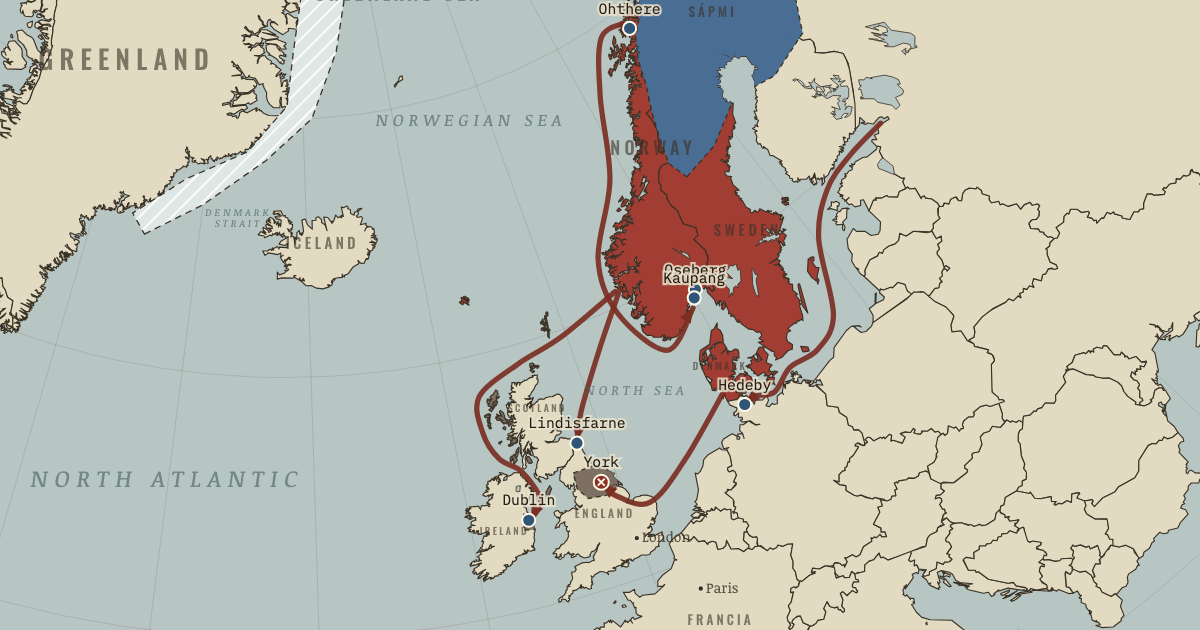 The Ship and the Sea RoadClimate and Innovation · chapter 2 · 866
Questions about this map
Which countries were in the World in 900?
The map data draws 115 states and other polities in the World in 900. The largest by land were the Alliance between Samanid Empire and Ziyadid dynasty, the Tang Dynasty, the Allegiance of Ziyadid dynasty to Abbasid Caliphate, the Abbasid Caliphate and Tibetans.
What was the largest empire in the world in 900?
Of the states on this map, the Alliance between Samanid Empire and Ziyadid dynasty held the most land in total: about 5.1 million km² in the reconstruction used here. Ancient and frontier borders are approximate, so treat areas as estimates.
Can I explore the World in 900 interactively?
Yes. Open the interactive map at 900, zoom into any region, move through the years, and ask the history guide questions: it answers in plain words and draws places, armies and borders on the map.
About these borders
The borders come from Cliopatria (v0.2.1, Seshat Global History Databank, CC BY 4.0), the dataset behind our interactive map, with our audited name and border corrections. It records each state's territory year by year from 3400 BC to 2024. Borders before modern surveys are reconstructions: the data draws a state where it held control, and frontier zones, nomadic realms and loose overlordships are approximate. Areas are measured on an equal-area projection. Read how we make our maps.
World in other years
- 3000 BC
- 2000 BC
- 1500 BC
- 1000 BC
- 750 BC
- 500 BC
- 323 BC
- 200 BC
- 100 BC
- AD 1
- 100
- 200
- 300
- 400
- 500
- 600
- 700
- 800
- 900
- 1000
- 1100
- 1200
- 1300
- 1400
- 1444
- 1453
- 1492
- 1500
- 1550
- 1600
- 1648
- 1700
- 1750
- 1776
- 1789
- 1800
- 1815
- 1830
- 1850
- 1871
- 1880
- 1900
- 1910
- 1914
- 1918
- 1920
- 1930
- 1938
- 1939
- 1940
- 1942
- 1945
- 1950
- 1960
- 1970
- 1980
- 1990
- 2000
- 2010
- 2020